
Vargas (state)
| Vargas / La Guaira | |||
|---|---|---|---|
 _(%2Bclaimed).svg) |
|||
| Symbols | |||
|
|||
| Basic data | |||
| Country | Venezuela | ||
| Capital | La Guaira | ||
| surface | 1496 km² | ||
| Residents | 372,700 (2017) | ||
| density | 249 inhabitants per km² | ||
| founding | 1998 | ||
| ISO 3166-2 | VE-X | ||
| Website | www.estadovargas.gob.ve (Spanish) | ||
| politics | |||
| governor | Jorge Luís García Carneiro | ||
| Political party | Partido Socialista Unido de Venezuela | ||


Coordinates: 10 ° 32 ′ N , 67 ° 4 ′ W
Vargas is a state of Venezuela named after the country's first non-military president, José María Vargas , who was born in the city of La Guaira. In 2019 the state was renamed La Guaira , after its capital La Guaira . The renaming is controversial.
history
On June 29, 1589, Don Diego de Osorio y Villegas founded the settlement of San Pedro de la Guaria, from which today's La Guaira developed. As a result, the port quickly became rich, as large parts of the hinterland were and still are supplied with goods via it. This wealth naturally attracted pirates and privateers; Despite the strategically important position, they were able to plunder and devastate the city several times.
From 1825 La Guaira belonged to the province of Caracas. Maiquetía was formed in 1850. Finally, in 1864, La Guaira and Maiquetía were merged into one district. In 1872 the federal district was formed, which in 1904 was again divided into two parts, one of which was the Vargas district. In 1986, Vargas was declared an independent city district, but it still remained part of the federal district . In 1998 the 23rd state of Venezuela was created here.

On December 15, 1999, the central part of Vargas suffered a severe flood disaster with landslides known as "La Tragedia" (the tragedy). Large parts of the population fled, with several small towns being practically abandoned. Tens of thousands of people died and two thirds of the state's population had to be evacuated. It rained as much in 24 hours as it normally did in two years.
In June 2019, the state was renamed La Guaira after its capital . However, this renaming is controversial.
geography
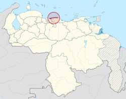
The state is located in the north of the country and borders Aragua to the west, Miranda to the east , the capital district to the south and the Caribbean Sea to the north .
The geology of the state corresponds to that of the entire coastal mountain range. The relief of the state is formed by a narrow coastal strip about 160 kilometers in length, which slopes steeply towards the sea. There are peaks that rise above the 2,000 meter mark, the highest mountain is Pico Naiguatá at 2,765 meters above sea level. NN .
The climate is tropical and warm. The annual average temperature fluctuates between 25.6 ° C and 27 ° C. According to the climatic classification of Köppen , this is a steppe climate, which is characterized by drought, as evaporation outweighs precipitation. The annual rainfall varies between 900 and 1530 mm.
vegetation
The tropical dry forests form a strip running parallel to the coast in which species such as mesquites , Caesalpinia coriaria , Tabebuia , Bursera simaruba , Ceiba and Hura crepitans live.
Administrative division
The state consists of a municipality that encompasses the entire state, which in turn consists of eleven parroquias . The total area is 1,497 km².
- Caraballeda
- Carayaca
- Carlos Soublette ( Maiquetía )
- Caruao (La Sabana)
- Catia La Mar
- El Junco
- La Guaira
- Macuto
- Maiquetía
- Naiguatá
- Raul Leoni (Catia La Mar)
population
According to estimates, the state has a population of 332,000 in 2007, compared with 280,439 in 1990. The population is distributed among the districts as follows:
- La Guaira (25,324)
- Catia La Mar (118,466)
- Maiquetía (58,074)
- Caraballeda (35,851)
- Carayaca (29,993)
- Naiguatá (18,576)
- Macuto (13,724)
- Caruao (4,156)
Law and government
- State government: The Constitution of Venezuela stipulates that the government is divided into an executive and a legislative branch. The governor chairs the executive branch , while the legislative council presides over the legislative branch . According to the 160th article of the Venezuelan constitution, the governor must be Venezuelan, over twenty-five and secular. He is elected for a term of four years by a simple majority. He can be re-elected.
- City government: The Venezuelan constitution stipulates that the city administration is also divided into an executive and a legislative branch. The district executive is headed by the mayor, while the legislature is formed by the city council.
economy

The main economic centers in the state are the port and the airport. Before the 1999 disaster, the state invested a lot of money in residential areas, social clubs , hotels , restaurants and other facilities. With the tragedy of 1999, many of these lines of investment fell, the land lost value and many clubs disappeared.
The port of La Guaira is the second largest port of Venezuela in terms of cargo volume and forms the main portal through which a large number of consumer goods enter the country, which are destined for Caracas and the states of La Guaira / Vargas, Miranda and Aragua.
The international airport Aeropuerto Internacional de Maiquetía Simón Bolívar in Maiquetía is about 21 kilometers from Caracas. Simply called Maiquetia by the population, this is the most important of the international airports in Venezuela. Flights to many major cities in the US, the Caribbean and Europe depart from here.
tourism
From the heights of the Ávila massif , one can see the winding coastline of the Caribbean Sea, lined with royal palms. There is the El Ávila National Park on 850 km² , with mountain fog. and rainforests, paramo vegetation and a rich avifauna. A few kilometers outside of Caracas there are extensive beaches: Playa Grande, Catia La Mar, Macuto, Caraballeda, El Palmar, Naiguatá and Anare. A road connects Chuspa and other villages to Higuerote, in the state of Miranda .
Web links
States:
Amazonas |
Anzoátegui |
Apure |
Aragua |
Barinas |
Bolívar |
Carabobo |
Cojedes |
Delta Amacuro |
Falcón |
Guárico |
Vargas (La Guaira) |
Lara |
Mérida |
Miranda |
Monagas |
Nueva Esparta |
Portuguesa |
Sucre |
Táchira |
Trujillo |
Yaracuy |
Zulia
Capital District :
Distrito Capital
Federal immediate area:
Dependencias Federales