Bewl Water
| Bewl Water | |||||||||
|---|---|---|---|---|---|---|---|---|---|
| The Bewl Water | |||||||||
|
|||||||||
|
|
|||||||||
| Coordinates | 51 ° 4 '36 " N , 0 ° 23' 53" E | ||||||||
| Data on the structure | |||||||||
| Height of the structure crown: | 33 m | ||||||||
| Crown length: | 1 800 m | ||||||||
| Drain tower in Bewl Water | |||||||||
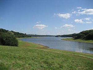
The Bewl Water is a reservoir in Kent , England . The lake is in the valley of the River Bewl south of Lamberhurst . The River Bewl rises east of the lake and leaves it on its north side. Numerous other unnamed tributaries also flow into the lake.
With a capacity of 31 million liters, the lake is the largest body of water in South East England. It provides drinking water for East Sussex and Kent.
When there is heavy rainfall, especially in winter, the reservoir is filled with water from the River Teise near Goudhurst and the River Medway near Yalding in addition to its natural inflow . During dry periods, water can then be pumped back into the rivers.
A 20 km long circular path leads around the lake, which can be used for cycling and hiking. Water sports are practiced on the lake itself.
Web links
- Bewl Water Website of the Bewl Water Estate
- Bewl Water on Southern Water
- Bewl Water 1968–2014 Wadhurst History Society website


