Bill Emerson Memorial Bridge
Coordinates: 37 ° 17 '43 " N , 89 ° 30' 57" W.
| Bill Emerson Memorial Bridge | ||
|---|---|---|
| The Bill Emerson Memorial Bridge from Cape Girardeau, MO to East Cape Girardeau, IL | ||
| Official name | Bill Emerson Memorial Bridge | |
| use | Road bridge | |
| Convicted | MO 34 , IL 146 | |
| Crossing of | Mississippi River | |
| place |
Cape Girardeau , Missouri East Cape Girardeau , Illinois |
|
| Building number | NBI 000002003632986 | |
| construction | Cable-stayed bridge | |
| overall length | 1,205 m | |
| width | 29 m | |
| Longest span | 350 m | |
| Construction height | 91 m | |
| height | 18 m | |
| vehicles per day | 10,600 | |
| building-costs | $ 100,000,000 | |
| start of building | 1996 | |
| opening | December 13, 2003 | |
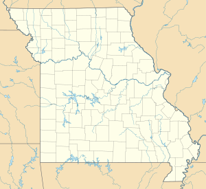
| location | ||
|
|
||
| Above sea level | 94 m | |
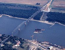
The Bill Emerson Memorial Bridge is a cable-stayed bridge , which the Mississippi between Cape Girardeau and East Cape Girardeau in the US -amerikanischen states Missouri and Illinois spans.
Missouri State Route 34 leads over the bridge from the west , which merges into Illinois State Route 146 on the bridge . The four lanes are used by more than 10,000 vehicles every day.
history
The bridge was built a few meters south of the original Cape Girardeau Bridge . This existed from 1928 until its demolition in 2004.
In 1996 construction work began on the new bridge. It was named after Bill Emerson (1938-1996), who represented the state of Missouri in the US House of Representatives between 1981 and 1996 .


