Boca Prins
| Boca Prins | ||
|---|---|---|
| Waters | Caribbean Sea | |
| Land mass | Aruba | |
| Geographical location | 12 ° 29 '55 " N , 69 ° 54' 31" W | |
|
|
||
Boca Prins is a bay on the northeast coast of the Caribbean island of Aruba .
description
The bay with a sandy beach in the Arikok National Park is a popular destination. The unguarded white sandy beach with dunes is only 55 meters long and offers no other facilities. Swimming can be dangerous due to the strong and constant undercurrent and is only recommended for experienced swimmers, if at all. The bay is occasionally visited by surfers, but is not considered one of the island's outstanding diving spots. A sandy path lined with limestone cliffs leads to the bay via wooden stairs.
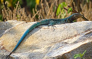
The rocks of Boca Prins are the habitat of Cnemidophorus arubensis , a racing lizard that is unique to Aruba.
Near Boca Prins is one of the oldest coconut plantations in Aruba, which was cultivated by Dutch settlers in the 16th century. The name of the bay is derived from the nearby Prins plantation.
Web links
- Photo series Boca Pins on arubabound.com
- Description of the bay on aruba.com
Individual evidence
- ↑ Boca Prins. In: beachesofaruba.com. Retrieved December 6, 2019 .

