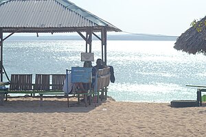
Kupang Bay
| Kupang Bay | ||
|---|---|---|
|
Tabalong Beach |
||
| Waters | Sawu Lake | |
| Land mass | Timor | |
| Geographical location | 10 ° 4 ′ S , 123 ° 40 ′ E | |
|
|
||
| width | approx. 12 km | |
| depth | approx. 16 km | |
| Islands | Kera , Tikus | |
|
Panmuti Beach ( Central Cupang ) |
||
The bay of Kupang is located on the southwest tip of the island of Timor , leading to the Lesser Sunda Islands belongs.
The Indonesian city of Kupang lies on its southern bank . At the entrance to the bay, which opens up to the Sawu Sea in the west , lies the small island of Kera and the island of Tikus in front of the peninsula to the north . An even smaller island lies off the north shore of the bay.
The Bay of Kupang is considered to be the best natural harbor in Timor, which is why it was early the target of various traders who bought sandalwood in Timor . At the end of the 16th century the Portuguese founded a base here, later came the Dutch , who built their first permanent settlement in Kupang in 1640, thus initiating the political division of Timor, which still exists today.
Individual evidence
- ^ Geoffrey C. Gunn: History of Timor. ( Memento of the original from March 24, 2009 in the Internet Archive ) Info: The archive link was inserted automatically and has not yet been checked. Please check the original and archive link according to the instructions and then remove this notice. Technical University of Lisbon (PDF file; 805 kB)


