Hermannstein Castle (Waltershausen)
| Hermannstein | ||
|---|---|---|
|
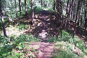
Wall trench section (2009) |
||
| Alternative name (s): | Steinfirst, Steinfurt and Wachkopf | |
| Creation time : | around 1250 | |
| Castle type : | Höhenburg, spur location | |
| Conservation status: | Castle stables, trenches and hill of ruins | |
| Standing position : | Local nobility | |
| Place: | Waltershausen | |
| Geographical location | 50 ° 52 '18.1 " N , 10 ° 34' 53.1" E | |
| Height: | 456.4 m above sea level NN | |
|
|
||
Hermannstein Castle is an abandoned high medieval fortification in the Waltershausen district of Schnepfenthal in the Thuringian district of Gotha .
Geographical location
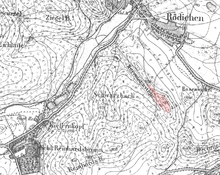
The castle stable of the Höhenburg is located on the northern edge of the Thuringian Forest just under 3.5 km southeast of Tenneberg Castle , around 2 km northeast of Friedrichroda and around 1 km south of the center of the Waltershausen district of Schnepfenthal on the eastern edge of the narrow, rocky mountain ridge Wachkopf ( 456, 4 m above sea level ). The former castle site is under the forest, a forest path cuts the western ramparts. The place is indicated by local path markings and is touched by the network of circular hiking trails around Friedrichroda. Below the castle, a medieval road from Friedrichroda ran in a north-easterly direction via Leina to Gotha.
description
The facility extended over a length of about 100 m to the summit of the Wachkopf , in the west four narrow section trenches and ramparts can be seen at a short distance across the mountain ridge. Only a few uneven floors indicate the location of previously existing buildings. The castle site is a protected ground monument . The area in question is used for forestry.
history
Steinfirst Castle was mentioned as a fortification of the Lords of Döllstädt in the Thuringian Chronicle of the Land of Eisenach, written by the Eisenach chronicler Johannes Rothe , from 1418 to 1419 . Its construction time, use and destruction are directly related to the Thuringian-Hessian War of Succession (1247–1263). According to tradition, the castle was destroyed as early as 1260 when the castle crew blocked the access routes to the Reinhardsbrunn monastery as robber barons .
Because of its excellent position as a lookout point, the mountain was provided with a guard several times, most recently during the Thirty Years' War , at the instigation of the Gotha Duke Ernst .
Name interpretation
The name Wachkopf is the name of the mountain that can be traced back to 1512 and is currently in use, Herrmannstein here refers to the name of a possible builder; According to Raimann , it is said to have been Landgrave Hermann I who commissioned the castle; but that is unlikely and would contradict the report of the chronicler Rothe. Until 1998 Hermannstein was also the name of an inn on the outskirts of Schnepfenthal. Steinfirst and Steinfurt are evidence of old but still common forest place names in the immediate vicinity of the castle and are also used in the Rothes Chronicle.
Others
A stone slab in the Reinhardsbrunn Palace Park is said to come from the castle. In 1988, the Waltershausen painter Michael Thiem made a mural for the entrance area of the Hermannstein restaurant , which has since been demolished , which shows a fictional image of this castle as a backdrop.
literature
- Thomas Bienert: "Burgstelle Hermannstein" - Medieval castles in Thuringia . Wartberg Verlag, Gudensberg-Gleichen 2000, ISBN 3-86134-631-1 , p. 88-89 .
- Michael Köhler: "Hermannstein, Steinfirst, Steinfurt, Wachkopf" - Thuringian castles and fortified prehistoric and early historical living spaces . Jenzig-Verlag, Jena 2001, ISBN 3-910141-43-9 , p. 137 .
- Wilhelm Bickel: Home book of Schnepfenthal - Rödichen in Thuringia . Publishing house of the municipality of Schnepfenthal-Rödichen, Waltershausen 1939.
- Heinz Raimann: The castle on the Hermannstein . In: Hörselberg-Bote . Issue 46. Heimat Verlag Hörselberg, Wutha-Farnroda 2001, p. 32-33 .
Web links
Individual evidence
- ↑ Map services of the Federal Agency for Nature Conservation ( information )
- ↑ Thuringian Land Surveying Office TK25 - sheet 5129 - Waltershausen , Erfurt 1997, ISBN 3-86140-065-0
- ^ Luise Gerbing : The field names of the Duchy of Gotha and the forest names of the Thuringian Forest between the Weinstrasse in the west and the Schorte (sluice) in the east; on behalf of the Association for Thuringian History and Archeology. and ed. by Luise Gerbing . Jena G. Fischer, 1910 ( archive.org [accessed May 23, 2020]).


