Burnt Islands
| Burnt Islands | ||
|---|---|---|
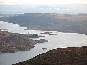
| Aerial view with the three Burnt Islands in the center | ||
| Waters | Kyles of Bute | |
| Geographical location | 55 ° 56 ′ N , 5 ° 10 ′ W | |
|
|
||
| Number of islands | 3 | |
| Residents | uninhabited | |
The Burnt Islands are a group of three islands in the Kyles of Bute Strait . Administratively they belong to the Scottish Unitary Authority Argyll and Bute . The islands are all uninhabited. Allegedly there is a burial site from the time of the Viking occupation.
The three islands are located near the northernmost point of the Kyles of Bute at the junction of Loch Riddon east of Buttock Point , the northernmost point of the island of Bute . The westernmost of the three islands is called Eilean Fraoich , which means heather island. It has a length of 280 m and a width of 160 m and is described as rocky with few trees. The largest island, Eilean Mòr , is 400 m long and 190 m wide. It is partially forested. The eastern Eilean Buidhe is only 100 m off the Cowal coast. It is the smallest of the islands with a length of 160 m and a width of 100 m. A historic dun on the island was first described in 1822 and uncovered in 1936. The almost circular complex was enclosed by walls up to four meters thick, which enclosed an area with a diameter of around 19.5 m. Today the masonry is preserved up to a height of 1.5 m.
Individual evidence
- ^ Entry in the Gazetteer for Scotland
- ^ Entry in the Gazetteer for Scotland
- ^ Entry in the Gazetteer for Scotland
- ^ Entry in the Gazetteer for Scotland
- ↑ Entry on Burnt Islands in Canmore, the database of Historic Environment Scotland (English)

