California State Route 480

|
|
|---|---|
| map | |

|
|
| Basic data | |
| Important city: | San Francisco |


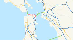
California State Route 480 , CA 480 for short , was intended as a state highway in San Francisco , California , consisting of the elevated, two-story Embarcadero Freeway (also known as Embarcadero Skyway ), the partially elevated Doyle Drive , which leads to the Golden Gate Bridge , and an undeveloped section in between. The Embarcadero Freeway was demolished after the Loma Prieta earthquake and Doyle Drive is now part of US Route 101 .
history
The lack of a complete freeway system within San Francisco was often criticized, only two complete freeways run through the city: Interstate 80 / US 101 from the Bay Bridge to the city limits in the south and Interstate 280 from 3rd Street towards Daly City.
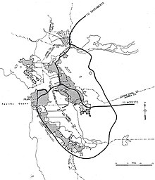
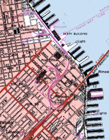
When building large freeways became popular in the 1960s, there were numerous proposals and plans to equip San Francisco with a network of freeways. Part of these plans was a direct link between the Bay Bridge and the Golden Gate Bridge . Part of this planned Freeway 480 should be the two-story Embarcadero Freeway. This ran from the Bay Bridge to a point just past Broadway. In order to reach the connection, however, the freeway would have had to be built through some narrow residential areas.
The California Highway Commission drew up a number of proposals for the route of the freeway from the current end of the Embarcadero Freeway to the Golden Gate Bridge and presented them in March 1965. After a public hearing the following month, a proposal was preferred that would be the freeway until Fort Mason should run between Bay Street and North Point Street. From there it would go past the Golden Gate Yacht Club, partly below sea level along the coast of Marina Green and finally on Doyle Drive, which acts as a feeder to the Golden Gate Bridge.
However, the city planners were not very enthusiastic about these plans and so the San Francisco Board of Supervisors suggested after further hearings to tunnel under Bay Street, North Point Street and Beach Street and to merge the freeway that was split up at Fort Mason from where from Doyle Drive through a tunnel below Marina Boulevard.
However, these plans, as well as other compromise proposals, all met with opposition. After the population was aware of the effects of a freeway that runs through the middle of a residential area, the so-called freeway revolts began in 1956 . These protests continued into the 1970s and often had the effect that planned and started freeways were no longer built.
Decline
The San Francisco Board of Supervisors proposed on November 5, 1985 that the Embarcadero Freeway be demolished. Against this proposal, however, resistance formed in the population, since the freeway was an important traffic axis for Chinatown and downtown. At that time the freeway at the level of the Ferry Building was used by around 70,000 vehicles daily; an additional 40,000 vehicles per day used attached entrances and exits on Main Street and Beale Street.
After the Embarcadero Freeway was damaged by the Loma Prieta earthquake on October 17, 1989, the California Department of Transportation therefore planned to repair and maintain the two-story freeway. But the then mayor Art Agnos , after he had secured the funding, was able to prevail with his idea of replacing the freeway with a boulevard. Agnos also planned an underpass at the Ferry Building and a large, open space in front of the building.
On February 27, 1991 the demolition of the twelve meter high and 150,000 ton heavy Embarcadero Freeway began. The demolition reconnected the coast to the city in what is now considered to be one of the best aftermaths of the earthquake and one of Agnos' greatest achievements. Partly due to the disgruntled traders and voters in Chinatown, he lost his re-election in 1992, but years later, on June 16, 2006, the Port of San Francisco unveiled a memorial and Agnos was honored for his vision and courage.
Today the Embarcadero is a popular nightlife area. Pier 39 just west of the Ferry Building is one of the main tourist destinations in the city. The famous San Francisco Cable Cars and the historic F Market & Wharves tram line bring locals and tourists to the Embarcadero.
Movies
The freeway has appeared in a few films including Dirty Harry II - Calahan , Freebie and the Bean , Bullitt , Crazy Family , Superman IV , Escape To The Future, and Koyaanisqatsi , as well as on several television shows such as Full House (in some aerial photos) and The Streets of San Francisco . In one shot at the beginning of Zodiac , the freeway behind a shot of the Ferry Building was digitally added.
