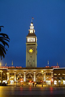
The Embarcadero (San Francisco)
The Embarcadero (Spanish for Landing Bridge ) is the road that runs along the San Francisco Bay from the Port of San Francisco on a causeway on the east coast of San Francisco , California . It was built on land that was reclaimed from the sea .
history
San Francisco's coastline originally ran south inland from Clarke's Point below Telegraph Hill to what is now Montgomery Street and east to Rincon Point and included a bay called Yerba Buena Cove. As San Francisco grew, the bay was replenished. In the 1860s, the construction of a large, upstream dam began. It took over 50 years to build it and replenish the mud flats to gain the land that is now San Francisco's Financial District .
At the beginning of the twentieth century the port was one of the largest hubs in the world, but the completion of the Bay Bridge and Golden Gate Bridge in the 1930s caused a sharp drop in passengers, and the relocation of freight to Oakland exacerbated the decline.
During the Second World War , the coastal strip developed into a logistics center: troops, equipment and food left the port for the Pacific. Almost every pier and shipyard was involved in military activities, assisting the troop carriers and warships along The Embarcadero.
In the 1960s, the Embarcadero Freeway was built. Although it made the Bay Bridge more accessible by car, it was by far the ugliest structure in town. For 30 years, the two-story freeway divided the coastal region and the Ferry Building from downtown San Francisco. It was demolished in 1991 after it collapsed partially in the 1989 Loma Prieta earthquake .
Extensive restructuring measures led to the construction of a palm-lined boulevards on the same site, public squares and parks have been created or restored, and the lines N Judah and T Third Street and F Market of Muni have been extended to run along the boulevard. The lines N and T run south of Market Street to 4th and King Streets (at AT & T Park and the Caltrain - stop ), and the line F north of Market Street to Fisherman's Wharf . The Market Street Railway is also planning a new 'E' line to run up The Embarcadero, past the quays, to Aquatic Park .
A sculpture, "Cupid's Span" by Claes Oldenburg and Coosje van Bruggen, was set up in 2003 in the Rincon Park area. The statue resembles Cupid's bow and arrow and symbolizes the place where Tony Bennett " lost his heart ".
Embarcadero Center
The Embarcadero Center is a business center consisting of six interconnected, from 30 to 45 floors tall skyscrapers (four office buildings and two Hyatt - hotels ) and another office building on a 40,000 square meter site in the neighboring Financial District . Designed by architect John C. Portman, Jr. , the buildings were completed between 1971 and 1989. Around 14,000 people work in them today.
One fountain, the Vaillancourt Fountain, is located at Justin Herman Plaza and Four Embarcadero Center, between the Ferry Building and the beginning of Market Street. Until 2001 there was a lookout point on the Embarcadero Center. During the winter holidays, the corners of the buildings are illuminated; it makes them look like huge books on a shelf.

