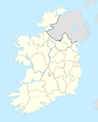
Callan
| Callan Callainn |
|||
| location | |||
| Coordinates: | 52 ° 33 ′ N , 7 ° 24 ′ W | ||
|
|||
| Data | |||
| Province: | Leinster | ||
| County: | Kilkenny | ||
| Height: | 68 m | ||
| Residents: | 2475 (2016) | ||
Callan ( Irish : Callainn ) is a country town in County Kilkenny in the central southeast of the Republic of Ireland .
The place
Callan is located in the west of County Kilkenny, near the border with County Tipperary ( South Tipperary ), and is one of the few larger towns in the county with 2,475 inhabitants according to the 2016 Census ; compared to the 1996 census, the population had doubled by 2016. The city was founded in 1207 by William Marshal, 1st Earl of Pembroke ; its name probably goes back to the Irish high king Niall Caille .
The place is 16 km southwest of Kilkenny Town on a bypass of the national road N76 from Kilkenny to the N24 to Clonmel or Carrick-on-Suir .
Attractions
In Callan, on the banks of the Kings River, you can visit the ruins of a 15th century Augustinian monastery called Abbey Meadow , as well as The Moat , one of the best-preserved Irish motte-type castles .
Gaelic football
The first game according to the revised, binding rules for Gaelic Football took place on February 15, 1885 in Callan.
Personalities
- James Hoban (~ 1762–1831), architect; born in Desart near Callan
- Edmund Ignatius Rice (1762–1844), lay brother and founder of an order
- George Tallis (1869–1948), Australian theater entrepreneur
- Thomas Kilroy (* 1934), writer
Web links
Individual evidence
- ↑ Map of Ireland (can be enlarged greatly)
- ↑ Callan (Town) on citypopulation.de, accessed on February 6, 2019

