Calverbühl
The Calverbühl (also Calver Bühl , formerly also Karpfenbühl ) is a striking 509 m above sea level. NHN high elevation south of Dettingen an der Erms in the Reutlingen district . On the summit of the Calverbühl there is a linden tree that is clearly visible from afar.
geology
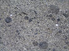
The Calverbühl is a small volcanic vent of the Swabian volcano . The rock is characterized by numerous lapilli . Geophysical measurements have shown that a strong geomagnetic anomaly occurs at the Calverbühl , which is caused by the ferromagnetic minerals ( mainly magnetite ) present within the volcanic rock.
In a more recent publication O. Mäussnest mentions that the magnetism of the Calverbühl was strengthened by lightning strikes.
natural reserve
The Calverbühl with the linden tree on the summit and the semi-dry grass on the slopes is a large natural monument under nature protection and is also protected as a geotope under the name Calverbühl approx. 1000 m south of Dettingen ad Erms on the west slope of the Ermstal . It is both in the conservation area Reutlinger and Uracher Alb and in the Swabian Alb Biosphere Reserve embedded.
Individual evidence
- ↑ Johannes Baier: The Urach-Kirchheimer volcanic area of the Swabian Alb. In: Aufschluss 71 (4), pp. 224–233, 2020.
- ↑ Johannes Baier, Günter Schweigert: The Calverbühl near Dettingen an der Erms. In: Fossilien 32 (6), pp. 56–59, 2015.
- ^ Otto Mäussnest: Geomagnetic investigations in the Kirchheim-Urach volcanic area. Jber. Middle Upper Rhine. geol. Ver. 38, pp. 23-54, 1956.
- ↑ Otto Mäussnest: The eruption points of the Swabian volcano, Part II ; in: Z. dt. Geol. Ges., 125, 1974, Hanover
- ^ Geotope profile of the LGRB
- ↑ http://rips-dienste.lubw.baden-wuerttemberg.de/rips/ripsservices/apps/naturschutz/schutzgebiete/steckbrief.aspx?id=4159002000263
Web links
Coordinates: 48 ° 31 ' N , 9 ° 21' E


