Camp Peak
| Camp Peak | ||
|---|---|---|
|
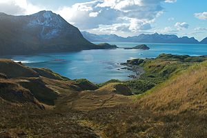
View over the Maiviken to Camp Peak (left) |
||
| height | 330 m | |
| location | South Georgia | |
| Coordinates | 54 ° 14 '35 " S , 36 ° 31' 23" W | |
|
|
||
The Camp Peak is a 330 m high mountain on the north coast of South Georgia . It rises to the north of the Thatcher Peninsula west of Maiviken Bay .
Scientists from the British Discovery Investigations , who mapped it in 1929, named it after a camp they had set up on the bank below the mountain.
Web links
- Camp Peak in the Geographic Names Information System of the United States Geological Survey (English)
- Camp Peak on geographic.org (English)

