Canada Water
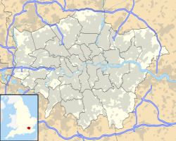
Canada Waters location in Greater London |
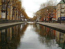
Canada Water is a freshwater lake and nature reserve in Rotherhithe (London) in Docklands . The Canada Water station is named after the lake, and is immediately north then, while the Surrey Quays Shopping Center connects to the south with Canada Water.
The lake was named after the former Canada Dock , a historic harbor basin, the northern third of which today forms the lake. The rest was backfilled. Canada Dock got its name because mainly ships from Canada docked there. Like many Docklands facilities, the Surrey Commercial Docks , which included Canada Dock, closed in the 1970s. In the 1980s, the London Docklands Development Corporation (LDDC) took over the site and invested heavily in urban development. About half of the Canada Dock was filled in and the Surrey Quais Shopping Center built on it. An ornamental canal, the Albion Channel (through the now filled Albion Dock ), was created, which connects Canada Water and Surrey Water . With the excavation, Stave Hill was raised in the nearby Russia Dock Woodland .
The area around the Thames gentrified quickly and when the Jubilee Line was extended in 1999, the focus shifted to the area directly on the lake. The opening of the Canada Water underground station ensured good access to local public transport; Canary Wharf is just one stop away, Westminster less than 10 minutes and Bond Street approximately 15 minutes.
Most of the site is currently being fundamentally rebuilt. There are new residential developments, a new library, cafes and restaurants, recreational sports facilities on the lake and even the establishment of a shopping street is planned.
Canada Water is the only freshwater lake in Docklands. During the renovation work in the early 1980s, part of the barrier layer was damaged and the water polluted. The LDDC repaired the damage and restored the water quality. The water inflow was supposed to be ensured by a pipe connection to the flooded tunnels of the London Underground , but the water could not be used for hygienic reasons. Now attempts were made to introduce water from the Thames, but the amount required would have been too large for the circumstances at the time. Finally, research by garden architect Fraser Borwick revealed that groundwater used to be pumped out for various industrial processes using wind power. When the Jubilee Line construction company inspected the boreholes , it was found that there was a large amount of drinking water in them, and so an 80 m deep borehole was drilled. The borehole was cased to a depth of 60 meters and the remaining 20 meters are in chalk cliffs. The water is brought up with a wind-powered pump and ensures that the lake is always filled with fresh water.
Web links
- Canada Water Urban Development Promotion Site
- Canada Water Consultative Forum & Canada Water Campaign
Individual evidence
Coordinates: 51 ° 29 '49.3 " N , 0 ° 2' 53.7" W.

