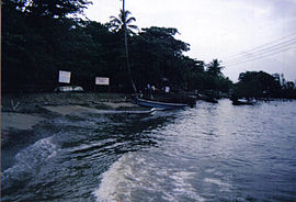
Capurganá
| Capurganá | ||
|---|---|---|
|
Coordinates: 8 ° 37 ′ N , 77 ° 20 ′ W Capurganá on the map of Chocó
|
||
| Basic data | ||
| Country | Colombia | |
| Department | Chocó | |
| Residents | 1222 (2005) | |
| Detailed data | ||
| surface | 0.707 km 2 | |
| Population density | 1,728 inhabitants / km 2 | |
| Waters | Gulf of Urabá | |
| Capurganá | ||
Capurganá is a Colombian Corregimiento with 1222 inhabitants (as of 2005), mostly descendants of African slaves, in the Municipio Acandí of the Chocó department on the northwest side of the Gulf of Urabá .
Capurganá, in the language of the Kuna Indians, the “land of red chili pepper”, is the border town to the Panamanian border station Puerto Obaldía, one hour away by sea, and tries to attract tourists. There are no road connections. The boat trip to Turbo on the other side of the gulf takes two hours. Some seaplanes maintain connections.
Individual evidence
- ↑ Population of Chocó on citypopulation.de
- ↑ Investors are welcome ( Memento of the original from July 1, 2009 in the Internet Archive ) Info: The archive link was inserted automatically and has not yet been checked. Please check the original and archive link according to the instructions and then remove this notice. . sueddeutsche.de. Accessed November 15, 2016
Web links
- Detailed description of the place on sueddeutsche.de , accessed June 29, 2009
- “Capurganá tesoro del Urabá chocoano” , tourist description on encolombia.com
- “Capurganá, un pequeño paraíso” , informative blog

