Carmacks
| Carmacks | ||
|---|---|---|
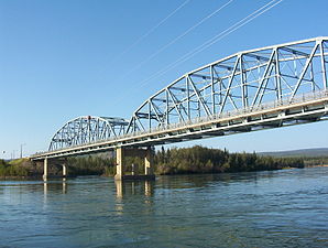
 View of Carmacks |
||
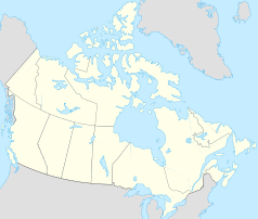
| Location in Yukon | ||
|
|
||
| State : |
|
|
| Territory : | Yukon | |
| Local community: | Village of Carmacks (Town) | |
| Coordinates : | 62 ° 6 ′ N , 136 ° 17 ′ W | |
| Area : | 36.95 km² | |
| Residents : | 493 (as of 2016) | |
| Population density : | 13.3 inhabitants / km² | |
| Time zone : | Pacific Time ( UTC − 8 ) | |
| Postal code : | Y0B 1B0 | |
| Area code : | +1 867 | |
 Bridge over the Yukon in Carmacks |
||
Carmacks is a community with 503 inhabitants (as of 2016) on the Yukon River in the Yukon Territory of Canada . She is one of only eight official communities in the territory and has legally the statute of a village ( English Village ).
The place is on the Klondike Highway and forms the western end point of the Robert Campbell Highway . One of four bridges over the Yukon is in Carmacks. About 7 kilometers west of the municipality is the local airfield ( IATA airport code : -, ICAO code : -, Transport Canada Identifier: CEX4). The airfield has only one runway that is 639 meters long.
The last official census , the 2016 Census , showed a population of 493 inhabitants for the settlement, after the 2011 census for the municipality still showed a population of 503 inhabitants. Compared to the last census in 2011, the population decreased by 2.0% and developed against the average for the territory, with a population increase of 5.8%. In the census period from 2006 to 2011, the population in the municipality had increased by 18.3%, while it only increased by 11.6% on average for the territory.
At the 2016 census, the average age of the residents was 36.6 years, well below the territory's average of 39.1 years. The median age of the residents was determined to be 36.7 years. The median age of all residents of the territory was 39.5 years in 2016. For the 2011 census, a median age of 34.3 years was determined for the inhabitants of the municipality, and 39.1 years for the inhabitants of the territory.
Indians of the Little Salmon / Carmacks First Nation living in the region. The place is named after George Carmack , a prospector , who for a long time was credited with finding gold at Bonanza Creek , which triggered the gold rush on the Klondike River . In the 1890s he discovered a coal seam near what is now the city . The Carmacks area is rich in coal, copper and gold that are industrially mined.
The Tagé Cho Hudän Interpretive Center provides information on the culture of northern Tutchone .
Web links
- Village of Carmacks (English)
- Little Salmon / Carmacks First Nation (English)
- Tagé Cho Hudän Interpretive Center, Museum of the Northern Tutchone (English)
Individual evidence
- ^ A b Carmack's Community Profile. Census 2016. In: Statistics Canada . August 9, 2019, accessed September 19, 2019 .
- ^ Carmacks Community Profile. Census 2011. In: Statistics Canada . May 31, 2016, accessed September 19, 2019 .
