Klondike Highway


The Klondike Highway is a road that connects the Alaskan coastal town of Skagway with Dawson City in the Yukon . The road runs parallel to the route used by prospectors in the Klondike gold rush of 1898.
In the Yukon, the road is referred to as Yukon Highway 2 , while in Alaska it is designated as Alaska Route 98 . Until 1978, the unopened section between the British Columbia and Carcross border had no official highway number, the highway north of Carcross to the Alaska Highway was designated Highway 5 , and the final section between Stewart Crossing and Dawson was called Highway 3 . The section through British Columbia is now administered by the government of the Yukon and is accordingly called Yukon Highway 2 .
course
The Klondike Highway winds its way up in Alaska for 15 mi (15 mi) over White Pass in the Coast Mountains and crosses the Canadian border there. The road crosses British Columbia for 35 mi (35 mi) and then reaches the Yukon and the Alaska Highway near the town of Whitehorse .
history
South Klondike Highway
The original 33 mi (53 km) known in the area as Carcross Road was originally considered part of the Alaska Highway in 1942 until a road to Marsh Lake was opened a year later . Referred to as Yukon Highway 5, it formed with what was then Highway 6, Tagish Road , (now referred to as Yukon Highway 8 ). The street was renamed Highway 2 in 1978 because it was newly added to the Klondike Highway System. During the 1980s, the highway was massively expanded. Residents who live up to 25 km (16 mi) from the Alaska Highway still give their address with the historical mileage that begins on the Alaska Highway, although these are no longer accurate due to corrections, and the milestones the distance to Specify the ferry terminal in Skagway.
Construction of the "Carcross-Skagway-Straße" began in the 1950s and was interrupted during the climb to a pass crossing. In 1976/77 construction resumed and in August 1978 the road between Skagway and Carcross was finished. This year the highway was open for a few weeks before closing for the winter. The first full season was 1979.
Originally built as a tourist road, the road gradually became more and more important for commercial traffic, marking the end of the White Pass and Yukon Railway , which is now only open to tourists. The new owners of the Faro mine agreed with the government that the road would remain open all year round. It was closed for the last time in the winter of 1985/86.
The stretch of highway between Carcross and Skagway was massively straightened and paved several times during the 1980s and 1990s. Although the road is no longer used by mining traffic, it is still popular with tankers and tourists. South of Carcross, the Klondike Highway runs along the west bank of Tutshi Lake .
North Klondike Highway
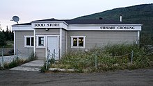
Road quality from Whitehorse to Dawson City was poor prior to 1950 and only suitable for the toughest and toughest of vehicles and travelers. The "Whitehorse-Mayo Road", the original Highway 2, ran from Whitehorse to Stewart Crossing and turned northeast to Mayo , Elsa and Keno City .
Main intersections
United States (Alaska)
| mile | kilometre | Destinations | Remarks |
|---|---|---|---|
| 0.00 | 0.00 | First Street - Skagway Ferry Terminal | Alaska Marine Highway |
| 24.00 | 38.62 | Border with Canada | North end of AK-98, south end of YT-1 |
Canada (British Columbia)
| place | kilometre | Destinations | Remarks |
|---|---|---|---|
| 0.00 | Border with the United States | North end of AK-98 |
Canada ( Yukon )
| place | kilometre | Destinations | Remarks |
|---|---|---|---|
| Carcross | Highway 8 East ( Tagish Road ) - Tagish , Alaska Highway, Atlin | West end of Highway 8 | |
| Carcross cutoff | Highway 1 East (Alaska Highway) - Teslin | Southern end of the parallel route of Highway 1 with the Alaska Highway | |
| Whitehorse | South Acess Road | ||
| Whitehorse | Two Mile Hill Road | ||
| Whitehorse | When Road | ||
| Whitehorse | Highway 1 West (Alaska Highway) - Haines Junction , Fairbanks | Northern end of the parallel route of Highway 1 with the Alaska Highway | |
| Carmacks | Highway 4 East ( Robert Campbell Highway ) - Faro , Ross River | Western end of the parallel route of Highway 4 and Robert Campbell Highway | |
| Stewart Crossing | Highway 11 East ( Silver Trail ) - Mayo , Keno City | West end of Highway 11 and the Silver Trail | |
| Highway 5 North ( Dempster Highway ) - Fort McPherson , Inuvik | South end of Highway 5 and Dempster Highway | ||
| Dawson City | To Highway 9 ( Top of the World Highway ) / Dawson City Ferry Terminal | Ferry to Highway 9; north end of Highway 2 |
