Fort McPherson (Northwest Territories)
| Fort McPherson | ||
|---|---|---|
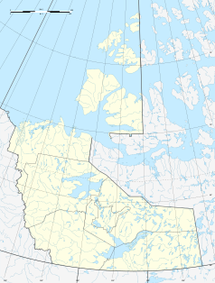
| Location in Canada | ||
|
|
||
| State : |
|
|
| Territory : | Northwest Territories | |
| Region: | Inuvik region | |
| Coordinates : | 67 ° 26 ′ N , 134 ° 53 ′ W | |
| Residents : | 776 (as of 2006) | |
| Foundation : | 1849 | |
| Website : | www.fortmcpherson.ca | |
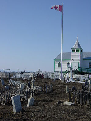
 chapel |
||
Fort McPherson ( Gwich'in : Teetl'it Zheh , dt .: "At the head of the water") is a community in the Canadian Northwest Territories , north of the Arctic Circle . In the 2006 survey, the municipality had 776 inhabitants.
It was founded in 1849 when John Bell, a researcher with the Hudson's Bay Company, set up a trading post along the Peel River . After numerous floods, it was later moved to a higher location. This branch was first named Peel River House , but later renamed after Murdoch McPherson.
Fort McPherson is located on the east bank of the Peel River , 121 kilometers south of Inuvik and is connected to it by the Dempster Highway . Spoken Gwich'in and English.
The place went down in history through a funeral. Buried in the cemetery next to the Anglican Church are Inspector Francis J. Fitzgerald, Constable GF Kinney, ROH Taylor and Sam Carter of the Royal Northwest Mounted Police (RNWMP), whose story of the Lost Patrol is still told today when it closed in 1910/1911 a dog-sleigh patrol from Fort McPherson to Dawson , but had to turn back due to the rigors of the arctic weather and apparently inaccurate local knowledge and froze to death about 30 miles from Fort McPherson on the way back and starved to death.
literature
- Melanie Fafard / Ingrid Kritsch: The History and Archeology of Fort McPherson , Gwich'in Social and Cultural Institute Tsiigehtchic 2005
