Mayo (Yukon)
| Mayo | ||
|---|---|---|
 |
||
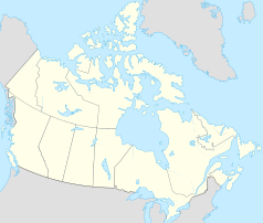
| Location in Yukon | ||
|
|
||
| State : |
|
|
| Territory : | Yukon | |
| Coordinates : | 63 ° 36 ′ N , 135 ° 54 ′ W | |
| Area : | 1.06 km² | |
| Residents : | 200 (as of 2016) | |
| Population density : | 188.7 inhabitants / km² | |
| Time zone : | Pacific Time ( UTC − 8 ) | |
| Postal code : | Y0B 1M0 | |
| Area code : | +1 867 | |
Mayo is a village on the Stewart River in the Yukon Territory, Canada, and one of only eight official parishes in the Territory. It has the legal statute of a village ( English Village ).
Of the population, around 110 belong to the First Nation of Nacho Nyak Dun . Their language belonged to Northern Tutchone , whose northernmost representative this group forms. A total of 546 people belonged to this predominantly traditional First Nation in August 2019 .
The village was named after the former circus acrobat Alfred Mayo (also known as Al Mayo) who ran a trading company in Alaska and the Yukon together with Jack McQuesten and Arthur Harper from 1873 . There are two motels, a post office, a liquor store, a hospital and a gas station in the village.
history
The Nacho Nyak Dun not only have Tutchone ancestors, but are z. Also related to the Gwich'in and the Dene. However, they are more closely linked to the Northern Tutchone of Selkirk around Pelly Crossing and the Little Salmon / Carmacks First Nation around Carmacks . Together with them, the three groups form the Northern Tutchone Tribal Council .
In pre-European history, the Nacho Nyak Dun were hunters and trappers. The tribe comprised two Moietys , the "crow" and "wolf" were called. The river known today as the Stewart River is called Náhcho Nyäk by the local First Nation , which means "Great River".
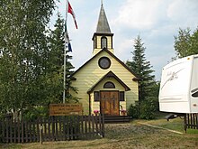
The Nacho Nyak Dun lived in what is now called Old Mayo Village on the other side of the Stewart. This settlement was again created on the initiative of a missionary. In 1936, however, the Stewart floods tore down significant parts of the village, including the church, and destroyed numerous cult objects.
The first gold discoveries were made in the Mayo region in the 1880s, and silver was added later. Mayo was supplied by boats until the 1950s, which were replaced by road traffic on the Klondike Highway and the Silver Trail. The Silver Trail connected Mayo to Stewart Crossing .
From 1973 to 1984 the northern Tutchone and the government negotiated in vain for land claims and the rights of use attached to them, as well as for self-government. In 1993, however, there was a breakthrough in both areas and, as a result, a contract. Accordingly, the tribe owns and legislates an area of 1,830 square miles and earns Canadian $ 14,554,654 over 15 years. Chief is Simon Mervyn Senior.
Together with the Tr'ondek Hwick'in First Nation they signed a contract with Yukon Energy to supply Dawson with electricity via the Mayo Dawson Power Line .
In May 2008 the tribe merged with the Alexco Resource Corp. a tentative silver mining agreement in the Keno Hill Silver District, not far from Mayo Lake above Mayo . There, in the area around Keno City and Elsa , Alexco owns around 40 silver mines.
Demographics
The last official census , the 2016 Census , showed a population of 200 inhabitants for the settlement, after the 2011 census for the municipality still showed a population of 226 inhabitants. The population decreased by 11.5% compared to the last census in 2011 and developed significantly against the average of the territory, there with a population increase of 5.8%. In the 2006 to 2011 census period, the number of inhabitants in the municipality had already decreased by 8.9%, while it increased by 11.6% on average for the territory.
At the 2016 census, the average age of the residents was 41.2 years, above the territory's average of 39.1 years. The median age of the residents was determined to be 43.0 years. The median age of all residents of the territory was 39.5 years in 2016. For the 2011 census, a median age of 45.1 years was determined for the inhabitants of the municipality, and 39.1 years for the inhabitants of the territory.
traffic
The community is connected via the Silver Trail (also Yukon Highway 11) with Stewart Crossing and there with the Klondike Highway (also Yukon Highway 2). About 3 kilometers north of the municipality is the local airport ( IATA airport code : YMA, ICAO code : CYMA, Transport Canada Identifier: -) the residents with the rest of the country. The airfield, like many of the airfields in northern Canada, only has a gravel runway of 1,476 meters in length.
Web links
Remarks
- ↑ a b Mayo Community Profile. Census 2016. In: Statistics Canada . August 9, 2019, accessed September 20, 2019 .
- ^ First Nation of Nacho Nyak Dun - Registered Population. Indigenous and Northern Affairs Canada , April 9, 2019, accessed September 20, 2019 .
- ↑ The contract (PDF, 499 kB 69 pages) with Canada and Yukon can be found here ( page no longer available , search in web archives ) Info: The link was automatically marked as defective. Please check the link according to the instructions and then remove this notice. . A summary is provided by the First Nation of Nacho Nyak Dun Self-Government Agreement
- ↑ Alexco Resource Corp. and the First Nation of the Na-Cho Nyak Dun Sign Cooperation Agreement. Newsfile, July 5, 2010, accessed September 20, 2019 .
- ^ 'No cloud' over mining plans after Alexco, Yukon First Nation sign deal, in: CBC News, May 26, 2008
- ↑ Mayo Community Profile. Census 2011. In: Statistics Canada . May 31, 2016, accessed September 20, 2019 .
- ↑ Canadian Airports Charts. (PDF; 76.9 MB) NAV CANADA , accessed on September 20, 2019 (English).

