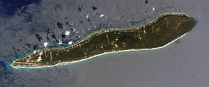
Cayman Brac
| Cayman Brac | ||
|---|---|---|
| NASA satellite image | ||
| Waters | Caribbean Sea | |
| Archipelago | Cayman Islands | |
| Geographical location | 19 ° 43 ′ N , 79 ° 48 ′ W | |
|
|
||
| length | 19 km | |
| width | 2 km | |
| surface | 38.8 km² | |
| Highest elevation | The Bluff 43 m |
|
| Residents | 1822 (1999) 47 inhabitants / km² |
|
| main place | West end | |
Cayman Brac is the easternmost and second largest with an area of 38.8 km² island of Cayman Islands . It is located about 140 km northeast of the main island of Grand Cayman . 1822 of the 39,020 inhabitants of the Cayman Islands live on this island (as of 1999).
Cayman Brac is approximately 19 km long and an average of 2 km wide.
The island was named after a limestone cliff. Brac is the Gaelic word for cliff.
The Cayman Brac Museum is located on the island .
Cayman Brac was discovered by Christopher Columbus in 1503 , as was the Little Cayman Island, located around 8 km to the west . The first residents were British settlers who came to the island in 1833. Among other things, because of the many caves, the island became a popular pirate hideout, where prey was often hidden; however, during strong hurricanes (such as the one in 1932, which wreaked havoc), the caves were also used as a protective refuge.
Charles Kirkconnell International Airport is located in the southeast of the island .
Web links
- Side of the island
- Cayman Brac page on www.caymanislands.ky
- Information about the island on naturecayman.com
Individual evidence
- ^ The Cayman Islands' Compendium of Statistics 2018: The Cayman Islands at a Glance - Surface Area. (PDF; 5.98 MB) In: eso.ky. Cayman Islands Government - Economics and Statistics Office, August 2019, p. 10 , accessed on May 9, 2020 .
- ^ Report of the Cayman Islands 1999 Population and Housing Census: Table 4: Number of Residents by District of Residence, Age Group and Sex. (PDF; 5.62 MB) In: eso.ky. Cayman Islands Government - Economics and Statistics Office, p. 17 , accessed March 24, 2020 .


