Cazenovia Lake
| Cazenovia Lake | ||
|---|---|---|

|
||
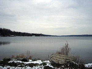
| Cazenovia Lake in late autumn 2005 | ||
| Geographical location | Madison County , New York , USA | |
| Drain | Chittenango Creek → Oneida Lake | |
| Data | ||
| Coordinates | 42 ° 56 '48 " N , 75 ° 52' 12" W | |
|
|
||
| Altitude above sea level | 366 m | |
| surface | 4.7 km² | |
| length | 6.2 km | |
| width | 1 km | |
| Maximum depth | 13.7 m | |
The Cazenovia Lake is a lake in the north of the state of New York east of the Finger Lakes region. It is about 6 km long, up to 1 km wide and up to 13.7 m deep. At its southern end it is drained by a drain into Chittenango Creek , which then flows into Oneida Lake and connects Cazenovia Lake with Lake Ontario .
Web links
- Cazenovia Lake in the Geographic Names Information System of the United States Geological Survey
- Cazenovia Lake on the New York State Department of Environmental Conservation website
- Cazenovia Lake on lakelubbers.com
Individual evidence
- ↑ a b c d Cazenovia Lake on the New York State Department of Environmental Conservation website (accessed December 18, 2015)
