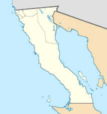
Cedros (place)
| Cedros | ||
|---|---|---|
|
Coordinates: 28 ° 6 ′ N , 115 ° 11 ′ W Cedros on the map of Baja California
|
||
| Basic data | ||
| Country | Mexico | |
| State | Baja California | |
| Municipio | Ensenada | |
| Residents | 1339 (2010) | |
| Detailed data | ||
| height | 30 m | |
Cedros , as Cedros Island called, is a village in the southwest of the island of Cedros Island in the municipality ( municipio ) Ensenada in the Mexican state of Baja California . Cedros is 30 meters above sea level.
