Isla de Cedros
| Isla de Cedros | ||
|---|---|---|
| East side of Isla de Cedros | ||
| Waters | Pacific Ocean | |
| Geographical location | 28 ° 12 ′ N , 115 ° 15 ′ W | |
|
|
||
| length | 39 km | |
| width | 18.6 km | |
| surface | 348.295 km² | |
| Highest elevation |
Monte Cedros 1205 m |
|
| Residents | 1350 (2005) 3.9 inhabitants / km² |
|
| main place | Cedros | |
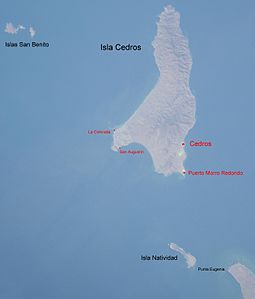
| Map with neighboring islands | ||
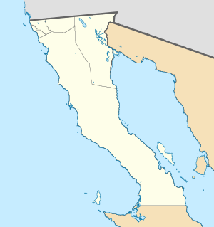
Isla de Cedros , German meaning cedar island , is an island off the coast of the Mexican state of Baja California in the Pacific . The island is 426 kilometers south of San Diego . It is 22 kilometers from the mainland (Punta Eugenia). The island has an area of 348.295 km². The most important of the eight settlements are Cedros (main town) and Punta Morro Redondo (port, airport). It forms one of the delegaciones of the Municipio Ensenada , which also includes the Islas San Benito , 15 km further west .
Geography and climate
The highest mountain is Monte Cedros with a height of 1205 m . The low points of the island have little rainfall, so deserts developed. At higher altitudes there are oaks , juniper bushes and pines . Fog can often be seen on the island . Large sea lion colonies can be found on the west side.
Every few years the island is hit by a hurricane .
Individual evidence
- ↑ Superficie Continental e Insular del Territorio Nacional ( Memento of August 17, 2007 in the Internet Archive )


