Chala lake
| Chala lake | ||
|---|---|---|

|
||
| Geographical location |
|
|
| Tributaries | underground | |
| Drain | underground | |
| Places on the shore | Chala | |
| Location close to the shore | Taveta | |
| Data | ||
| Coordinates | 3 ° 19 ′ 0 ″ S , 37 ° 42 ′ 0 ″ E | |
|
|
||
| Altitude above sea level | 877 m | |
| surface | 4.2 km² | |
| length | 3 km | |
| width | 2.4 km | |
| volume | 0.34 km³ | |
| Maximum depth | 90 m | |
| Middle deep | 81 m | |
| Catchment area | 3.38 km² | |
|
particularities |
Crater lake |
|
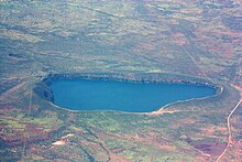
The Chala Lake (also Jala Lake) is a crater lake, through the middle of which the border between Tanzania and Kenya runs.
description
The lake is at an altitude of 877 m and is about 8 km north of Taveta . It is deep blue and surrounded by a crater rim up to 100 m high. The lake is fed by groundwater currents from Kilimanjaro and also drains underground with a throughput of approx. 10 million m³ / year. The chala also loses volume. Its level has dropped 2.4 m in the last 6 years.
The body of water is home to the endemic cichlid Oreochromis hunteri (Lake Chala tilapia).
Web links
Commons : Lake Chala - collection of images, videos and audio files
Individual evidence
- ↑ Study on the Kenyan groundwater systems (PDF; 687 kB)
- ↑ fishbase.org

