Champs Fleurs
| Champs Fleurs | ||
|---|---|---|
|
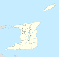
Coordinates: 10 ° 39 ′ N , 61 ° 26 ′ W Champs Fleurs on the map of Trinidad and Tobago
|
||
| Basic data | ||
| Country | Trinidad and Tobago | |
| region | San Juan Laventille | |
| Residents | 8310 (2011) | |
| Detailed data | ||
| City structure | 3 communities | |
Champs Fleurs is a city in Trinidad and Tobago . It is located in the northwest of the island of Trinidad in the San Juan-Laventille region .
location
Champs Fleurs is located in the middle of the East-West Corridor , the metropolitan region of the state capital Port of Spain south of the Northern Range from west to east . Since Port of Spain is bounded in the north by the Northern Range and in the south by the Caroni Swamp , the city expanded to the east over time. The resulting East-West Corridor is so densely populated that in the past independent cities merge into one another and now have the character of districts of the capital agglomeration. However, they are still formally independent. Champs Fleurs is bordered by San Juan to the west , Valsayn to the southeast, and St. Joseph to the east . Politically, the city belongs to the constituency of St. Joseph. Champs Fleurs is divided into the communities Champs Fleurs, Mount D'Or, Mount Hope and Mount Lambert.
| Community | Residents |
|---|---|
| Champs Fleurs | 1739 |
| Mount D'Or | 2412 |
| Mount Hope | 2218 |
| Mount Lambert | 1941 |
| total | 8310 |
history
The founding of the city goes back to the Cedula de populacion , an edict of the Spanish minister José de Gálvez y Gallardo , which in 1783 allowed the increased settlement of French citizens on the Spanish island of Trinidad until 1797 and thus a significant increase in population and a rapidly increasing economic output of the island made possible. In the area of today's Champs Fleurs, French-born planters settled and founded sugar cane and coffee plantations. One of the largest plantations in Trinidad was that of the de Fontenelle family. In the late 19th century, the de Fontenelles contract workers of Indian origin settled on the plantation site, and the name of the plantation, Champs Fleurs (German: flower fields), carried over to the workers' villages and later to the city.
Economy and Transport
Champs Fleurs is located on Eastern Main Road, one of the two most important west-east traffic axes in Trinidad. The Uriah Butler Highway , the main north-south highway , begins in Champs Fleurs. The larger of the country's two international airports, Piarco International Airport , is located about ten kilometers southeast in Piarco.
Due to its convenient location, industry has settled along the Eastern Main Route, such as the Carib Brewery , which is the largest brewery in the Caribbean, Unilever administration and production for the entire Caribbean region (Unilever Caribbean) and the Trinidadian branch of British American Tobacco, West Indian Tobacco.
Facilities and culture
The University of Applied Sciences School of Business and Computer Science is located in Champs Fleur; the only other educational institutions in town are a primary school and a secondary school. With the Eric Williams Medical Sciences Complex and the Mt. Hope Women's Hospital, two hospitals are located in Champf Fleurs, the former being the seat of the medical faculty of the Trinidadian branch of the University of the West Indies and the North Central Regional Health Authority.
The steel band Phoenix is based in Champs Fleurs.
Individual evidence
- ↑ Census 2011
- ^ Caribbean History Archives: The Matriarch. Retrieved April 3, 2016 .
- ↑ Health.gov.tt: North Central Regional Health Authority. Retrieved April 3, 2016 .

