Chibabava (district)
| Chibabava district | |
|---|---|
 Location of the Chibabava district in Mozambique |
|
| Basic data | |
| Country | Mozambique |
| province | Sofala |
| surface | 6991 km² |
| Residents | 121,154 (2013) |
| density | 17 inhabitants per km² |
| ISO 3166-2 | MZ-S |
Coordinates: 20 ° 18 ′ S , 33 ° 39 ′ E
Chibabava is a district of the Sofala province in Mozambique with the administrative seat in the city of Chibabava . Its territory is bordered by the Manica Province to the north and west, the Machanga District to the south and the Buzi District to the east .
geography
The main rivers of the district are the Buzí , Revué and Lucito rivers .
The east of the country is tropically humid because of its proximity to the coast. The interior is tropical semi-arid to dry, with an average rainfall of 500 to 800 millimeters per year.
population
| As in most districts in Mozambique, the population is very young, in Chibabava 49 percent of the population are under 15 years old. What is striking about this district is the unequal distribution of the sexes. In 2009, 56.2 percent of the population were female; this proportion had decreased to 54.2 percent by 2014.
The proportion of illiterate people in the district is above the average in Sofala province. Older women are more severely affected. Over 90 percent of women over the age of thirty are illiterate. |
 Gender distribution of the population of the Chibabava district |
Facilities and services
In the district there are (as of 2013) 99 primary schools ( Primárias) and five secondary schools (Secundárias). Of the primary schools, 80 are public and 19 are privately run, of the secondary schools only one is public and four are private schools.
There are eleven health centers and an ambulance in Chibabava.
Administrative division
The district of Chibabava is divided into three administrative posts ( postos administrativos ):
| Administrative post | Residents (as of 2005) | ||||
|---|---|---|---|---|---|
| (Age in years) | 0-4 | 5-14 | 15 - 44 | 45-64 | over 64 |
| Chibabava | 2,693 | 3,398 | 5,789 | 1,435 | 427 |
| Goonda | 4.147 | 5,564 | 9,579 | 2,345 | 937 |
| Muxúngue | 10,980 | 12,660 | 22,939 | 5,811 | 1,980 |
Economy and Infrastructure
In 2007 only 0.3 percent of the population had access to electrical energy (12 percent in Sofala province). Only six percent got the drinking water from a well, 44 percent from a river or pond.
Agriculture
In 2010 there were 20,000 farms averaging 2.5 hectares of land. Most of the acreage was (as of 2003) for maize (5,500 hectares), millet (5,000 hectares) and vegetables (3,000 hectares). The highest yields were found in vegetables (5,900 tons), corn (2,200 tons), millet (1,900 tons) and cassava (1,800 tons).
traffic
The EN 1 national road crosses the Chibabava district from south to north. The road network has a total length of 435 km.
Others
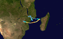
Chibabava was one of the districts that was badly hit by cyclone Idai in early March 2019. Of the eleven locations examined, ten had buildings that were completely destroyed. Malaria occurred in all locations, and malnutrition, acute respiratory illnesses and diarrhea occurred in at least eight locations.
Individual evidence
- ↑ a b c d Republica de Mozambique, Perfil do Distrito do Chibabava. (pdf) 2005, accessed 6 May 2019 (Portuguese).
- ↑ a b c Instituto Nacional de Estatístic, Estatísticas do Distrito de Chibabava. (pdf) November 2013, accessed 6 May 2019 (Portuguese).
- ↑ Cyclon Idai, Mozambique Rapid Assessment, Chibabava. REACH, April 2019, accessed on May 6, 2019 .
