Cima Crench
| Cima Crench | ||
|---|---|---|
|
Cima Crench |
||
| height | 778 m slm | |
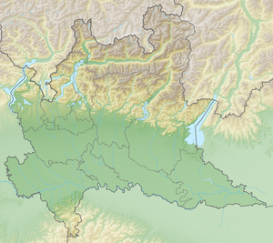
| location | Lombardy , Italy | |
| Coordinates | 45 ° 44 '50 " N , 10 ° 29' 39" E | |
|
|
||
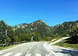
The Cima Crench , also called Cocca d'Idro, is a much- climbed , 778 m slm high summit in Lombardy , which can be reached via a via ferrata route. It is the local mountain of the Idro municipality . It is located east of the southern part of Lake Idro and northeast of Idro.
Via ferrata route
The starting point for the via ferrata tour is Crone ( 378 m slm ), a district of Idro. The via ferrata, created in 2007, leads to a pre-summit, the Punta Pelada ( 632 m slm ). From there the summit can be reached on a hiking trail that leads past a war tunnel (see Mountain War 1915–1918 ). The route offers a view of Lake Idro. The level of difficulty of the via ferrata is indicated on the Hüsler scale as difficult (K3-4).
Web links
Commons : Cima Crench - collection of images, videos and audio files
- Via ferrata tour to the Cima Crench on via-ferrata.de - accessed on January 21, 2017
- Map at peakhunter.com - accessed January 21, 2017
Individual evidence
- ↑ Eugen E. Hüsler: Hüsler's via ferrata guide Lake Garda . Bruckmann Verlag, 2012, ISBN 978-3-7654-5937-5 , p. 82 f .


