Conselheiro Lafaiete
| Conselheiro Lafaiete | ||
|---|---|---|
|
Coordinates: 20 ° 40 ′ S , 43 ° 47 ′ W Conselheiro Lafaiete on the map of Brazil
|
||
| Basic data | ||
| Country | Brazil | |
| State | Minas Gerais | |
| City foundation | September 19, 1790 | |
| Residents | 127,539 (2018 estimate) | |
| City insignia | ||
| Detailed data | ||
| surface | 370.246 | |
| Population density | 344 inhabitants / km 2 | |
| height | 995 m | |
| Post Code | 36400-000 | |
| City Presidency | José Milton | |
| Website | ||
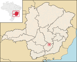
| Location of Conselheiro Lafaiete in the state of Minas Gerais | ||
Conselheiro Lafaiete is a city in the Brazilian state of Minas Gerais . It was founded in 1790 and, according to an estimate, had about 127,500 inhabitants in an area of 370.246 km² in 2018. It is located at an altitude of 995 meters.
Conselheiro Lafaiete was named Queluz until 1934. It was then named after the politician Lafayette Rodrigues Pereira, who came from this city .
economy
The iron ore mine Morro da Mina was operated near the village .
Web links
Commons : Conselheiro Lafaiete - Collection of images, videos and audio files
Individual evidence
- ^ Brazilian Institute of Geography and Statistics . 2018. Retrieved March 6, 2019: "2018 Estimates of Population"


