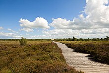
Corlea Trackway
The Corlea Trackway (also Corlea 1) is one of four Iron Age and therefore relatively young boardwalk paths that lead over a moor in the townland of Corlea ( Irish An Chorr Liath ) near Kenagh in County Longford in Ireland . It is an Irish national monument . The Corlea Trackway Visitors Center was built as a museum on site.
The links excavated by Barry Raftery (1944-2010) from the University of Dublin are about one kilometer long, four meters wide and made of 15 cm thick oak planks. The Corlea 1 Trackway ends after 1000 m on a small island in the moor, in front of which a second, equally long boardwalk leads to the other side of the moor. Both were born in 147 BC. Built in BC. The date determined using the Belfast chronology ( tree ring chronology ) is the only known date of a boardwalk from the 2nd century BC. In Ireland. The purpose of the boardwalk is unknown. The route could only be used for a short time. Within a decade she sank into the moor. A part of the way can be seen as a reconstruction at a visitor center.
The 1.8 km long Sweet Track in the British Isles is a much older boardwalk that leads over a marshland in the county of Somerset . The tree trunks used were around 3,800 BC. Like. Some of the north German plank paths are much older.
See also
literature
- Barry Raftery: Pagan Celtic Ireland: The Enigma of the Irish Iron Age, London 1994 Thames & Hudson, ISBN 0-500-05072-4
Web links
Coordinates: 53 ° 37 '36.3 " N , 7 ° 51' 12.4" W.

