Crookwell
| Crookwell | |||||
|---|---|---|---|---|---|
 Crookwell (2013) |
|||||
|
|||||
|
|||||
|
|||||
|
|||||
|
|
|||||
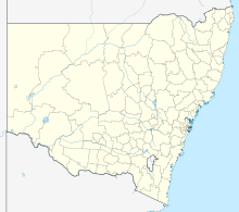
Crookwell is an Australian city in the Upper Lachlan Shire district in the state of New South Wales .
population
At the last census in 2016, Crookwell had 2,641 residents. Although the city is rather small in terms of population by Australian standards, it is still significant because its catchment area is large. Accordingly, there are several shopping opportunities in the city, including the Independent Grocers Alliance .
Infrastructure
The city has primary and secondary schools. There is also a hospital in the city.
One of the city's landmarks is Linder's sock factory, an emigrant family from Bavaria in the fourth generation.
Web links
Commons : Crookwell, New South Wales - Collection of pictures, videos and audio files
Individual evidence
- ↑ a b Australian Bureau of Statistics : Crookwell ( English ) In: 2016 Census QuickStats . June 27, 2017. Retrieved January 26, 2020.
- ↑ https://www.lindnersocks.com.au
