Dún Dúchathair
Coordinates: 53 ° 6 ′ 16 ″ N , 9 ° 41 ′ 15 ″ W.
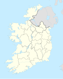
Dún Dúchathair [ duːn ˈduːxahɪɾʲ ] (older also Dún Dubhchathair , Anglicized Doocaher , German "The Black Fort " ) is a large stone promontory fort on the Aran island of Árainn (Inishmore), which belongs to County Galway in Ireland . It is located in the far east of the island, about two kilometers from the main town of Cill Rónáin .
The separation of the Dúchathair from the surrounding area, which lies on the tongue of land Dúnach Ard ( Doonaghard ) , which is partially washed away by the sea , was carried out by an approximately 70.0 m long dry stone wall that seals off the limestone cliffs . In terms of construction, the straight wall that kinks at the end can be compared with those of the large ring forts such as Cahergall , Cashel by Kilmovee , Dun Ballynavenooragh , Grianán by Aileach or Staigue Fort . The inside wall, which is laid out in terraces on three steps, has been preserved up to a height of five to six meters. Inside, next to the wall, you can see some remains of assembled, oval or elongated clochans . Outside the fort, traces of a Cheval de frise (a so-called cavalry lock) can be seen, as shown by Dún Aonghasa . Historically, Dúchathair has received less attention than the less remote Dún Aonghasa. Yet Dúchathair is hardly less remarkable. It may be considerably older. It is one of seven stone forts in the Aran Islands.
See also
literature
- Kennet McNally: Standing Stones and other Monuments of early Ireland . Appletree Press, Belfast 1984, ISBN 0-86281-121-X
- Paul Gosling: Archaeological Inventory of County Galway Volume 1: West Galway 1993 ISBN 0-7076-0322-6
Web links
- Dúns on Aran (pictures of the fort)

