Daisen (mountain)
| Daisen | ||
|---|---|---|
|
West view |
||
| height | 1729 m | |
| location | Tottori Prefecture , Honshu , Japan | |
| Coordinates | 35 ° 22 '16 " N , 133 ° 32' 47" E | |
|
|
||
| Type | extinct stratovolcano | |
|
The highest point of the Daisen |
||
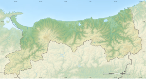
The Daisen ( Japanese 大 山 , German "big mountain") is a 1729 meter high volcano in Japan and the center of the Daisen-Oki National Park . It is located in the southwest of Honshū in Tottori Prefecture , about 20 km south of the coast. The towns of Yonago and Kotoura lie at its feet .
The three main peaks of the mountain have been largely unstable since an earthquake. The highest peak, Kengamine (1729 m), is therefore closed to mountaineers. Only the 1709 m high secondary peak Misen is open to mountaineers. It can be reached within three hours from the Daisen-ji Buddhist temple, which is about halfway up the mountain. For religious reasons, climbing the mountain is only permitted if accompanied by a monk from the monastery.
The Daisen plays a role in a variety of religious practices and ideas in Japan, which are collectively referred to as the Daisen Shinko.
Web links
- Suzuki Masataka: "Daisen Shinko" . In: Encyclopedia of Shinto. Kokugaku-in , March 28, 2007 (English)
- Pictures from the Daisen Oki National Park


