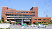
Yonago
| Yonago-shi 米 子 市 |
||
|---|---|---|
| Geographical location in Japan | ||
|
|
||
| Region : | Chūgoku | |
| Prefecture : | Tottori | |
| Coordinates : | 35 ° 26 ' N , 133 ° 20' E | |
| Basic data | ||
| Surface: | 132.21 km² | |
| Residents : | 147,667 (October 1, 2019) |
|
| Population density : | 1117 inhabitants per km² | |
| Community key : | 31202-9 | |
| Symbols | ||
| Flag / coat of arms: | ||
| Flower : | azalea | |
| Bird : | Dwarf swan | |
| town hall | ||
| Address : |
Yonago City Hall 1 - 1 , Kamo-chō Yonago -shi Tottori 683-8686 |
|
| Website URL: | http://www.city.yonago.lg.jp/ | |
| Location Yonagos in Tottori Prefecture | ||
Yonago ( Japanese 米 子 市 , - shi ) is a coastal city in Tottori Prefecture on Honshū , the main island of Japan and is located on the coast of the Sea of Japan . The city is the second largest city in this prefecture.
history
Yonago is an old castle town . Their castle was last administered by the Ikeda von Tottori . The castle fell into disrepair after the Meiji Restoration in 1868.
Yonago became a city on April 1, 1927 by including various parishes.
traffic
Yonago is the main city in western Tottori Prefecture. It is a traffic and trade center in the Chūgoku region . The Yonago Airport of the same name is located in a suburb of Yonago .
- Train:
- Street:
- Yonago highway
- Sanin highway
- National road 9
- National Road 180,181,183,431,482
Town twinning
sons and daughters of the town
- Otowa Nobuko (1924–1994), actress
- Takami Akai (* 1961), Japanese illustrator, character designer and game creator
- Masato Ishiwa (* 1996), football player
Neighboring cities and communities
- Tottori Prefecture
- Shimane Prefecture
Web links
Commons : Yonago - collection of images, videos and audio files


