Dampier Archipelago
| Dampier Archipelago | ||
|---|---|---|
| The Dampier Archipelago and the Burrup Peninsula | ||
| Waters | Indian Ocean | |
| Geographical location | 20 ° 32 ′ S , 116 ° 41 ′ E | |
|
|
||
| Number of islands | 42 | |
| Main island | Enderby Island | |
| Total land area | 185.60 km² | |
| Residents | uninhabited | |
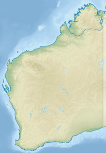
The Dampier Archipelago ( English Dampier Archipelago ) is an archipelago of 42 largely uninhabited islands and rocks on a lake area of around 1,000 km². He is part of the Dampier Ward of the Local Government Area (county) Karratha City in the Western Australian region Pilbara . The Montebello Islands are 88 kilometers to the west .
The individual islands are very different sizes of about one hectare to 3290 hectares (Enderby Iceland). It is located in the eastern Indian Ocean in front of the city of Dampier . It got its name after the English privateer William Dampier , who sailed here in 1699 and named one of the islands Rosemary Island . After Dampier, the eastern Burrup Peninsula was formerly called Dampier Island by British settlers . The Mermaid Sound , the main waterway to Port Dampier, divides the archipelago into an eastern and western group.
Nördlichster point of the archipelago Cape Legendre on Legendre Iceland, at 20 ° 21 '20 " S , 116 ° 49' 54" O . Easternmost island is Delambre Island, westernmost Egret Island, and southernmost West Intercourse Island.
A field study by the Western Australia Museum with the participation of researchers from 15 nations revealed a biodiversity of around 3200 species for the area of the archipelago. The biodiversity of the region is thus similar to that of the Great Barrier Reef off the coast of Queensland. Most of the islands are under nature protection, but should be made accessible to ecotourism under certain conditions . The islands directly on the coast are partly industrial areas, East Intercourse Island belongs to the port of the city of Dampier.
The islands of the archipelago are home to one of the largest collections of Australian rock art , particularly rock carvings up to 30,000 years old , which are considered to be the largest collection of petroglyphs in the world. Until the 1860s there were places of worship of the Aboriginal tribe of Jaburrara on the islands, which members of other tribes also visited.
In 1868 up to 150 Jaburrara were killed during the Flying Foam massacre by the British colonizers after an incident on a pearl fishing boat, since then the islands have gradually been depopulated, and since 1963 at the latest they have been uninhabited.
The Dampier Archipelago and the Burrup Peninsula have been entered on the Australian National Heritage List as cultural assets worthy of protection since July 3, 2007 .
Islands
![]() Map with all coordinates of the Dampier Archipelago: OSM
Map with all coordinates of the Dampier Archipelago: OSM
Individual evidence
- ↑ Australia's Islands on australia.com (accessed August 30, 2012)
- ↑ Research highlights biodiversity of Dampier Archipelago . Report from abc News online from November 26, 2004
- ↑ http://www.naturebase.net/national_parks/management/pdf_files/dampier_issues.pdf ( Memento from August 27, 2006 in the Internet Archive ) (pdf; 32 kB) Dampier Archipelago Management Plan (2002)
- ↑ http://www.dpa.wa.gov.au/files/PDPfinal_18Mar05.pdf ( Memento from September 28, 2007 in the Internet Archive ) (pdf; 6.8 MB) Development report of the port authority, 2004 (English)
- ↑ [1] ( Page no longer available , search in web archives ) Info: The link was automatically marked as defective. Please check the link according to the instructions and then remove this notice. Australian Heritage Database
- ↑ http://www.burrup.org.au/ntwa ( Memento from December 16, 2006 in the Internet Archive ) The Dampier Rock Art Precinct
- ↑ Timeline ( Memento of the original from November 3, 2012 in the Internet Archive ) Info: The archive link was inserted automatically and has not yet been checked. Please check the original and archive link according to the instructions and then remove this notice. on pals.dia.wa.gov.au (accessed August 30, 2012)
- ↑ Dampier Archipelago Nature Reserves Management Plan 1990-2000 ( Memento of the original of March 12, 2011 in the Internet Archive ) Info: The archive link was automatically inserted and not yet checked. Please check the original and archive link according to the instructions and then remove this notice. (PDF; 378 kB), page 4
- ↑ [2] ( Page no longer available , search in web archives ) Info: The link was automatically marked as defective. Please check the link according to the instructions and then remove this notice. ( MS Excel ; 3.0 MB)

