De Witt Island
| De Witt Island | ||
|---|---|---|
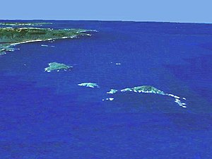
| De Witt is on the left in front of the mainland coast | ||
| Waters | South pacific | |
| Archipelago | Maatsuyker Islands | |
| Geographical location | 43 ° 35 '51 " S , 146 ° 21' 35" E | |
|
|
||
| length | 3.3 km | |
| width | 2.4 km | |
| surface | 5.17 km² | |
| Highest elevation | 354 m above sea level NN | |
| Residents | uninhabited | |
| map | ||
De Witt Island is the largest of the Maatsuyker Islands and has an area of 517 hectares. Located near the south coast of Tasmania , it is also part of the Southwest National Park . Although it is currently uninhabited, it was used for a long time, mainly for logging, but also as an occasional dwelling.
Flora and fauna
The island is largely forested with eucalyptus trees. In some places you can also find the Tasmanian elm and low vegetation.
On the island there is a somewhat richer biodiversity, so there are mainly sea and waders , such as z. B. Little penguins , the short-tailed shearwater , the dark shearwater , fairy petrels , diving petrels , thick-billed gulls or the sooty oystercatcher , as well as swallow parakeets . Mammals are also represented, including the red-bellied filander , rabbit kangaroos and rats . There are also reptiles with different types of skinks on the island.


