Maatsuyker Island
| Maatsuyker Island | ||
|---|---|---|
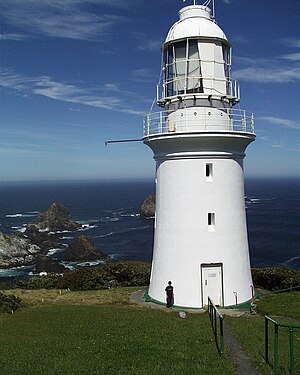
| The island's lighthouse , with the Needle Rocks in the background | ||
| Waters | South pacific | |
| Archipelago | Maatsuyker Islands | |
| Geographical location | 43 ° 39 '18 " S , 146 ° 16' 23" O | |
|
|
||
| length | 2.5 km | |
| width | 1.3 km | |
| surface | 1.86 km² | |
| Highest elevation | 284 m | |
| Residents | uninhabited | |
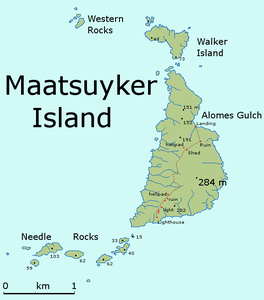
| map | ||
Maatsuyker Island is the main island of the Maatsuyker Islands . It is the second largest in the archipelago and has an area of 186 hectares. Located near the south coast of Tasmania , it is also part of the Southwest National Park .
climate
Because of the not inconsiderable distance to the equator , the climate on the island is quite cool and colder than in Australia for most of the year. The temperature that prevails on the island for most of the year is 10 ° C. Wind is almost always to be found on the island.
Flora and fauna
The vegetation on the island consists largely of South Sea myrtle , which covers most of the areas on the island. It can grow to a height of 6 meters.
A few sea birds and waders have been found on the island , such as B. Little penguins , the short-tailed shearwater , the dark shearwater , fairy petrels , diving petrels , black- billed gulls or the soot-oystercatcher , as well as the mouse Antechinus minimus . Different species of seals breed on the island.


