Maatsuyker Islands
| Maatsuyker Islands | ||
|---|---|---|
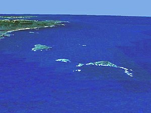
| Location of the Maatsuyker Islands; top left the Tasmanian south coast | ||
| Waters | Pacific Ocean | |
| Geographical location | 43 ° 38 ′ S , 146 ° 18 ′ E | |
|
|
||
| Number of islands | 6 (+ 2 rock groups) | |
| Main island | Maatsuyker Island | |
| Total land area | 8 km² | |
| Residents | uninhabited | |
| Map of the Maatsuyker Islands | ||
The Maatsuyker Islands are a group of islands in the South Pacific that belongs to the Australian state of Tasmania . They are only a few kilometers off the south coast of the island of Tasmania.
geography
![]() Map with all coordinates: OSM | WikiMap
Map with all coordinates: OSM | WikiMap
The group, which stretches from northeast to southwest over about 13 kilometers as the crow flies, includes six small islands and two rock island groups :
| Island name | Alias | Coordinates | surface | Residents | annotation |
|---|---|---|---|---|---|
| De Witt Island | 43 ° 36 ' S , 146 ° 21' E | 5.17 | - | ||
| Flat Witch Island | 43 ° 37 ′ S , 146 ° 17 ′ E | 0.64 | - | ||
| Walker Island | 43 ° 38 ' S , 146 ° 16' E | 0.15 | - | ||
| Western rocks | 43 ° 38 ′ S , 146 ° 19 ′ E | 0.01 | - | Archipelago | |
| Flat Top Island | 43 ° 38 ' S , 146 ° 23' E | 0.01 | - | ||
| Round Top Island | 43 ° 39 ′ S , 146 ° 22 ′ E | 0.01 | - | ||
| Maatsuyker Island | 43 ° 39 ′ S , 146 ° 17 ′ E | 1.86 | - | ||
| Needle rocks | 43 ° 40 ′ S , 146 ° 15 ′ E | 0.15 | - | Archipelago |
Occasionally, although far away, are added: the Breaksea Islands , Eddystone Rock , Kathleen Islands , Mewstone , Pedra Branca , Shanks Islands and the Trumpeter Islands .
use
Only on the main island of Maatsuyker Island are there buildings, a lighthouse that is now operated automatically, an unmanned weather station and a small helicopter landing pad.
The islands are part of Tasmania's Southwest National Park .
Web links
- Lighthouse and weather station on Maatsuyker Island (illustrated, English)


