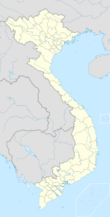
Deo-Ngoan-Muc nature reserve
Coordinates: 11 ° 50 ′ 0 ″ N , 108 ° 40 ′ 0 ″ E
The Deo Ngoan Muc Nature Reserve in Vietnam was approved on August 9, 1986 by Decree 194 / CT. With this decision, 2000 hectares of land in the South Vietnamese provinces of Lâm Đồng (German: Lam Dong) and Ninh Thuận (German: Ninh Thuan) have been placed under protection.
topography
The area of the protected area lies in the transition zone between the coastal plain of South Vietnam and the Da-Lat plateau . It increases steadily from west to east. The altitude coordinates are between 200 and 900 m . An important national road also runs right through the area: Route 20 connects Nha Trang in the east with Phang Rang in the west.
landscape
Due to the steep slope, the area is not suitable for large areas of agriculturally usable areas, so that it is not used for agriculture by humans. That is why there are still green rainforests in the lower plains. In the higher elevations, on the other hand, you will find evergreen mountain rainforest.
Danger
These forest forms are very badly damaged, which is why it is very unlikely to find a species-rich fauna of mammals and birds. In the lowlands, forests in particular are at risk from progressive degradation. The human influences are too great here, especially due to the connecting road. This will continue to exert pressure on the remaining forest reserves. The steep forest slopes of the high altitude areas are also at risk of erosion due to deforestation, which sometimes prevented the connecting road from being buried. Nevertheless, the area has a share of the lively tourism because the landscape offers beautiful pictures.
Web links
- "Profile" of the nature reserve (English)
- Rainforest Travel - Deo Ngoan Muc Nature Reserve (German)
- Birds in Indochina (English)
literature
- Storey, R. and Robinson, D. (1995) Lonely planet travel survival kit: Vietnam. Third edition. Hawthorn: Lonely Planet Publications.
