Dobellus Mały
| Dobellus Mały | ||
|---|---|---|

|
||
| View of the Dobellus Mały (back) | ||
| Geographical location | Dubeninki Municipality , Warmian-Masurian Voivodeship , Poland | |
| Places on the shore | Stańczyki | |
| Data | ||
| Coordinates | 54 ° 17 '41 " N , 22 ° 38' 49" E | |
|
|
||
| Altitude above sea level | 194.5 m npm | |
| surface | 0.0058 km² | |
| length | 105 m | |
| width | 75 m | |
| volume | 35 700 m³ | |
| scope | 285 m | |
| Maximum depth | 13.6 m | |
| Middle deep | 6.1 m | |
|
particularities |
||
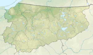
The Dobellus Mały ( German Little Dobellus ) is a lake in the Polish Warmian-Masurian Voivodeship . It is located west of the road from Stańczyki (Staatshausen) to Błąkały (Blindgallen) . The river Błędzianka (Blind) , the upper reaches of the Rominte, flows east of the lake .
nature
The shallow lake is separated from the Dobellus Duży (Great Dobellus) only by a narrow land bridge . Between 1930 and 2005, the area of the lake decreased from 1.5 to 0.58 hectares. The small lake has a relatively large amount of water of 35,700 m³. Its maximum length is 105 m, the maximum width 75 m (on average 56 m), with a maximum depth of 13.6 m. On average, the lake is 6.1 m deep.
history
On June 30, 1926, it was so affected by a thunderstorm with hail that a 2 to 3 meter high water fountain shot up from its center. After that, a brownish mass of putrefactive sludge welled up, gradually covering the whole lake.
Professor André from Königsberg made the following statement about this: A large amount of swamp gas had formed in the digested sludge of the lake bed . A thunderstorm created a local negative pressure that increased the buoyancy of the digester gases. As a result, parts of the sea bed came to the surface and floated around on it, since they were lighter than water as a result of their gas penetration.
The sludge dried up and was overgrown with plants, so that the lake seemed to have disappeared. However, greater rainfall softened the mud cover, which then crumbled into small pieces and finally sank to the bottom. On August 21, 1926, the last of the remains had sunk and the "lost lake" was back. In Polish it is called “wybuchowe jezioro” (explosive lake) .
Web links
- goldap.org.pl: SZANOWNA REDAKCJO . (Polish, May 30, 2015)
literature
- Johannes Mignat: The district of Goldap. An East Prussian homeland book. 1965, p. 61.
- S. Srokowski: Jeziora i moczary Prus Wschodnich. Warszawa 1930.
Individual evidence
- ↑ SZANOWNA REDAKCJO . (as above)
- ↑ Wybuchowe jezioro. (Polish, accessed March 14, 2018)
