Doon Fort
Coordinates: 54 ° 49 ′ 45 " N , 8 ° 27 ′ 47" W.
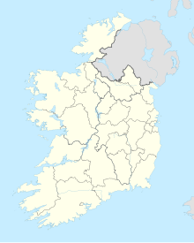
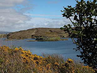
Doon Fort ( Irish An Dún ; also called The Bawan or O Boyle's Fort) in Lake Doon Lough ( Loch an Dúin ) in the townland of Drumboghill ( Droim Buachaill ), about 9.0 km north of Ardara, in County Donegal in Ireland . is a unique intermediate form between Dun and Crannóg . Parallels can be found in Dun Burga Water on the Shetlands and Dun Cromore on Lewis and Harris in Scotland . The oval stone wall is 45 m in diameter and takes up almost the entire area of a small island. The well-preserved wall is about five meters high and four meters wide at the base. A short section of the north-west wall of the approximately 3,000 year old facility has collapsed.
A gap in the wall provides access to the interior. On the left side of the passage, an opening via an eight-meter-long, very narrow and only slightly more than one-meter high corridor and a staircase provide access to the top of the wall. The six meter long access on the right is even narrower and lower. Inside the dun, four steps, about one meter high, lead to the wall, which has a low parapet on the outside.
Nearby
The crescent-shaped Drumboghill Gold Lunula was found in a nearby swamp in 1909.
About 800 meters to the northwest, on an island in Lough Birrog, with a stone dam as access, another, but destroyed, dun. Another equivalent is the Crannóg in Lough-Na-Crannagh near Ballycastle in County Antrim in Northern Ireland .
literature
- Gillian Hovell: Visiting the Past: A Guide to Finding and Understanding Britain's Archeology . 2009, ISBN 9780752448336 .
- Aidan O'Sullivan: Crannogs, Lake-dwellings of early Ireland , Country House, Dublin 2000, ISBN 1-86059-091-8 p. 14

