Tihany Hermit Caves
The hermit caves of Tihany (Hungarian: Barátlakások ) are located on the Tihany peninsula on the north bank of Lake Balaton .
Geographical location
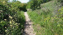
The hermit caves are located at an altitude of about 165 meters on the northern slope of the 207 meter high Óvár mountain between the districts of Tihanyvár and Gödrös. From the top of the Calvary in Tihany, a narrow footpath leads at the same height along the southwest slope of the Óvár mountain. After about two kilometers the path turns north and shortly afterwards east around the Óvár mountain and after a few meters reaches the caves. This footpath leads through a landscape with so-called "Pannonian lawns", which are home to numerous rare and protected plants.
A shorter footpath starts at a parking lot at the end of Kecskeköröm utca in Gödrös. Another footpath climbs steeply from Lepke sor, the road that leads to Tihany on the north bank of the peninsula, about 300 meters before the Tihany ship bridge, to the caves. This footpath leads past the Cyprian spring (Hungarian: ciprián forrás). The original name of the spring was "Russen-Brunnen" (Hungarian: Orosz kútnak), which can be interpreted to mean that the hermits were Russian Basilians . On all signposts, the caves are only called “Barátlakások” in Hungarian.
The Óvár mountain is a basalt tuff rock . There are remains of earth jumps on its summit.
history
At the end of the Bronze Age the earth castle was built on the Óvár hill. It was a royal residence and a place of refuge for the population in times of war. On their south side there are barrows of their inhabitants. These were archaeologically developed around 1970. Shards of earthenware, bronze jewelry and charred wheat grains were found.
From the 12th century on, Greek Orthodox hermits began digging caves in the eastern slope of Óvár Mountain. Following the pattern of Laura , they dug a chapel, a dining room and other caves facing east. Due to the orientation of the altars in the cells to the east, the unusually high number of altars and the earlier designation of Tihany as Oroszkö = Russian stone, it can be assumed that the inhabitants of the hermitage were Russian Basilians.
In 1952, many of these caves were destroyed by a rock fall. Today only three caves remain, which were protected by stabilization measures in 1994.
The hermit caves are under monument protection.
literature
- Marcus Stöckl, Rosemarie Stöckl-Pexa: Hungary West: Between Balaton, Budapest and Mecsek. 50 tours. With GPS tracks (Rother hiking guide) , Bergverlag Rother; Edition: 1 (March 1, 2011), ISBN 978-3763340705
Individual evidence
- ↑ a b c http://www.tihany-info.hu/downloads/Tihany_2006_de.pdf
- ↑ a b c http://www.tihany.hu/index.php/de/latnivalok-de/termeszet-de
- ↑ a b http://byzantinorossica.org.ru/sources/vizant/BZ/BZ_54(1961).pdf , p. 169
- ↑ http://www.hungariantourism.com/de/tihany/
- ↑ http://muemlekem.hu/muemlek?id=10539
Web links
Coordinates: 46 ° 55 '21.7 " N , 17 ° 52' 43.7" E

