Ejido Tabasco
| Ejido Tabasco | ||
|---|---|---|
|
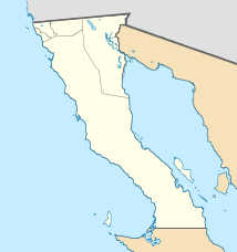
Coordinates: 32 ° 34 ′ N , 114 ° 56 ′ W Ejido Tabasco on the map of Baja California
|
||
| Basic data | ||
| Country | Mexico | |
| State | Baja California | |
| Municipio | Mexicali | |
| Residents | 1029 (2010) | |
| Detailed data | ||
| height | 25 m | |
Ejido Tabasco is a place in the municipality ( delegación ) Ciudad Morelos of the Municipio (municipality) Mexicali in the Mexican state of Baja California . It is located near the border with the US state of Arizona and the Mexican state of Sonora , 5 km east of the town of Tecolotes (Delegación Benito Juárez) and 8 km southwest of the town of Ciudad Morelos . The nearest major city is San Luis Río Colorado .
