
Evangelical cemetery Bad Homburg vor der Höhe

The Evangelical Cemetery on Saalburgstrasse is a cemetery in Bad Homburg vor der Höhe . The whole complex is under monument protection . Many famous residents of the city are buried here. It is the oldest of the spa town's nine cemeteries and includes around 3,440 graves.
history
The existence of the Unterkirchhof near the Untertor has been documented since 1455. This cemetery must have been on the site of today's cemetery or in its immediate vicinity.
The cemetery itself was first mentioned in 1647 as a Lutheran cemetery. The reason for the mention was the expansion of the cemetery to include Mutz's garden. In 1729 the cemetery was enlarged again and enclosed with a wall in 1744–50. In 1714, a churchyard house was built from the building materials from the Fleischschirn, which had been demolished next to the town hall. Until the founding of the Catholic cemetery on Gluckensteinweg around 1850, the (few) Catholics of Homburg were also buried here (if they were not buried in Kirdorf ).
Entrance gate

Around 1900 the entrance was moved to its current location. A baroque portal in red sandstone with the wrought iron gates from the workshop of Wilhelm Merle welcomes the visitor , donated by the Hammelmann siblings and designed by Louis Jacobi . The side posts are crowned by urns, which were modeled on the (not preserved) burial equipment of the court ladies Luise and Christiane von Ziegler.
The chapel

After the “death house” from 1714 and the replacement building from 1842, the “morgue” was built in 1883.
The new mourning hall

In 1960 the parish of the Erlöserkirche decided to build a new cemetery chapel. The parish contributed to the financing with 116,000 DM (in today's purchasing power 270,000 euros) and the city of Bad Homburg with 25,000 DM. The building, built according to drafts by government master builder Franz Hufnagel , was handed over on December 30, 1962. The main room offers 50–60 seats. A comprehensive renovation of the mourning hall took place after the turn of the millennium. Structural and technical defects were fixed for around 125,000 euros.
Graves
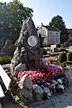
A number of graves of well-known personalities, mainly from the 19th and 20th centuries, are located in the cemetery. Among them are the graves of the court painter and photographer Johann Friedrich Voigt , by Dr. Trapp, Dr. Baumstark, sculptors May and Louis Jacobi. The geologist Dr. Friedrich Rolle and the aviator Johannes Nehring and the monumental family grave of Gustav Weigand (great mourners in marble by Fritz Gerth ) should also be mentioned. In 1865, the grave monument for Heinrich Ernst Zipperlein († 1849) was built based on a design by Christian Holler , who had been in charge of the school reform since 1831 and was co-founder of the infant care institution in 1842. In the front area of the wall there are gravestones of the spa guests who died in Homburg and the stone with inscriptions on the fatal robbery on March 28, 1834 at the leather dealer Friedrich Philipp Wernborn.
The grave chapel of the Ph. Trittler family is centrally located. The grave chapel of the Prof. Julius Froeling family (1871–1908 high school teacher in Homburg) is a building built in 1902 based on a design by Louis Jacobi.

Grave of Louis Jacobi
Friedrich Rolle grave

Grave of Heinrich Ernst Zipperlein

Grave of Johann Friedrich Voigt


Web links
literature
- Heinrich Jacobi, On the history of the Homburg cemeteries, in: Taunusbote August 25-27, 1919
- Heinrich Hett, On the history of the Bad Homburg cemeteries, in: Taunusbote November 18 and 19, 1953.
- Eva Rowedder, Monument Topography of the City of Bad Homburg vdH, ed. from the State Office for Monument Preservation Hessen, Stuttgart: Theiss, 2001, pp. 343–345.
Individual evidence
- ^ State Office for the Preservation of Monuments Hesse (ed.): Evangelical Cemetery Bad Homburg in front of the height In: DenkXweb, online edition of cultural monuments in Hesse
Coordinates: 50 ° 13 ′ 54.1 ″ N , 8 ° 36 ′ 23.7 ″ E