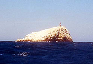
Farallón Centinela
| Farallón Centinela | ||
|---|---|---|
| Farallón Centinela from the southeast | ||
| Waters | Caribbean Sea | |
| Archipelago | Leeward Islands | |
| Geographical location | 10 ° 48 '52.8 " N , 66 ° 5' 25.2" W | |
|
|
||
| length | 98 m | |
| width | 68 m | |
| surface | 0.32 ha | |
| Highest elevation | 28 m | |
| Residents | uninhabited | |
Farallón Centinela (in German about "Guardian Cliff") is a small, uninhabited rock island in the Caribbean Sea , 25.5 km north of Cabo Codera on the Venezuelan north coast near the city of Higuerote , and 23 km northeast of Punta Majagual . The island belongs to the city of Higuerote, the capital of the Brión district in the state of Miranda .
La Tortuga Island, which is already part of the Dependencias Federales , is 74 km to the east.
The guano-covered rock reaches a height of 28 meters (39 meters according to other sources) and has an area of less than one hectare . It was formed in the Cretaceous Period . A lighthouse was built on the summit .
205 meters north is the smaller island of Islote Faralloncito ( diminutive of Farallón, cliff), which has an area of just under 50 square meters in plan .
Web links
literature
- (2001). Enciclopedia Océano de Venezuela. Editorial Océano, Barcelona, España. ISBN 84-494-1818-6

