Fataga
| San Bartolomé de Tirajana municipality: Fataga | ||
|---|---|---|
 Location of the mountain village
|
||
| coat of arms | Map of the Canary Islands | |
 Help on coat of arms |
|
|
| Basic data | ||
| Autonomous Community : | Canary Islands | |
| Province : | Las Palmas | |
| Island: | Gran Canaria | |
| Coordinates | 27 ° 53 ′ N , 15 ° 34 ′ W | |
| Residents : | 370 (2011) INE | |
| Postal code : | 35108 | |
| Area code: | 35019001300 | |
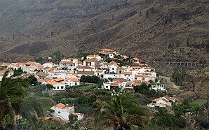
Fataga is a place on the island of Gran Canaria . It is located in the interior of the island and belongs to the municipality of San Bartolomé de Tirajana . The village is characterized by a well-preserved, historical center, old, narrow streets with natural stone paving and many Canarian houses that have been preserved in their original state. Fataga lies in the valley of a thousand palm trees , between brown rugged rocks, in the middle of a narrow band of green. The otherwise barren mountain slopes are adorned by pine groves.
Restaurants, tourist shops and an art shop with small pottery work round off the townscape. The antique bakery was shut down at the end of 2006. In the old town there are opportunities to stay overnight and to go on tours or hikes in the closest surroundings. The global bus travels to the south and north several times a day.
The village was badly affected in the great forest fire in 2007. In addition to individual buildings, a particularly large number of plants were burned here. The residents have largely removed the traces of the fire.

