Fiddler's Elbow
| Fiddler's Elbow | ||
|---|---|---|
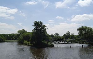
| Fiddler's Elbow - with the arm of the river to the weir on the right (looking downriver) | ||
| Waters | Thames | |
| Geographical location | 51 ° 43 ′ N , 1 ° 14 ′ W | |
|
|
||
Fiddler's Elbow is an island in the Thames upstream from Sandford Lock , at Kennington in Oxfordshire .
Fiddler's Elbow is shaped like a leg that tapers upstream from the broad end downstream. The main shipping route runs east of the island, while an arm divided by a weir runs west of it. Two smaller weirs at the lower end of the island create two more small islands. There is only grassland on the island.

