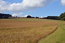
Finkenhof (Hochhausen)
The Finkenhof north of Hochhausen in the Neckar-Odenwald district is a historic manor on the plateau of the Karlsberg am Luttenbach. Since 1803 it belonged to the Grand Duchy of Hesse with its district as an exclave .
history
While the surrounding area of the Finkenhof came to the Grand Duchy of Baden in 1805/06 , the Finkenhof had come to the Grand Duchy of Hesse in 1803 and from then on formed a Hessian exclave in Baden, like the Wimpfen Forest with the Helmhof and Wimpfen .
In 1812 the estate came into the possession of Franz Ludwig von Helmstatt (1752–1841). His tomb in the form of a tomb pyramid, erected in 1844, is located in a wood above the estate.
After the Second World War , there was a unilateral change in the area, when in 1945 the occupation authorities attached the Hessian exclaves to Baden. Three spatially separated districts of Bad Wimpfen were transferred to other communities with effect from April 1, 1952 (Helmhof an Neckarbischofsheim in the district of Sinsheim, Zimmerhöferfeld in Bad Rappenau also in the district of Sinsheim and Finkenhof an Hochhausen in the district of Mosbach).
Hessen continues to insist on the position that the exclaves belong to Hessen under constitutional law, but tolerates Bad Wimpfen "being treated as part of Baden-Württemberg in administrative jurisprudence and legislation."
In 1952 the Finkenhof from Bad Wimpfen was incorporated into Hochhausen . On January 1, 1972, Hochhausen was incorporated into Haßmersheim with the Finkenhof .
literature
- Beatrix Geßler-Löhr: The grave pyramid of Count Franz Ludwig von Helmstatt . In: Kraichgau. Contributions to landscape and local research, volume 15/1997, pp. 315–329, Ed. Heimatverein Kraichgau, Eppingen 1997, ISBN 3-921214-14-9
Web links
supporting documents
- ^ Erich Schmied: The constitutional position of the city of Bad Wimpfen . In: Journal of Württemberg State History . Year 31, 1972. Kohlhammer, 1973, ISSN 0044-3786 , p. 346-357 .
- ^ Joachim Jänsch: Bad Wimpfen in the Bergstrasse district? Separated from Hessen for 60 years . In: History sheets district Bergstrasse . tape 38 . Laurissa, 2005, ISSN 0720-1044 , p. 222-246 .
Coordinates: 49 ° 19 '58.2 " N , 9 ° 5' 15.2" E


