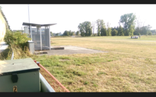
Aichach airfield
| Aichach airfield | |
|---|---|

|
|
| Characteristics | |
| Coordinates | |
| Height above MSL | 438 m (1437 ft ) |
| Transport links | |
| Distance from the city center | 1.5 km north of Aichach |
| Basic data | |
| opening | 1965 |
| operator | LSV Aichach |
| Start-and runway | |
| 02/20 | 580 m × 30 m grass runway with 270 × 5 m asphalt strips |
The airfield Aichach is a Segelfluggelände in Aichach-Friedberg , Bavaria .
location
The course is located in the district of Aichach -Nord in the valley of the couple at an altitude of 438 m above sea level. NN .
history
In the 1930s there were first glider flights on the slope of the Ecknachtal, where the industrial area south of Aichach is today. In 1936 the first buildings (flying barracks, workshops) were erected there. After the end of the war, it was not until 1950 before a local flying club was founded again. At the beginning of the 1960s, the city provided the present site. In 1965, the license to operate was granted on an initially 450 m long track. This was extended to today's size as part of the land consolidation in 1982.
Airfield

The runway 02/20 (also 36/18 to avoid confusion) is 580 meters long and 30 meters wide and has an asphalt runway 270 meters long and 5 meters wide. The operator of the airfield is the LSV Aichach. This has several ultralight aircraft , two motor gliders, a mobile two-drum take-off winch and a rope retrieval vehicle. The airfield also has a tower, a gas station and a hangar. For noise protection reasons, when approaching runway 02 (36), attention must be paid to a nearby football field and residential areas not to be overflown. Also note the church tower of the parish church of the Assumption when approaching. Runway 02/20 crosses a road secured by a barrier.