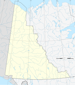
Fort Reliance (Yukon)
Fort Reliance was a trading post founded in 1874 and existing until 1886 in the Canadian Northwest Territories or the later Yukon . Although the fort was on Canadian territory, it was owned by the Alaska-based Alaska Commercial Company , based in the United States . The fort was built at the same time in the area of the Hän , later known as Tr'ondek Haw'in First Nation , the Athapaskan group of the later founded Dawson . The post was located 10 km below the confluence of the Klondike with the Yukon River , where the Klondike gold rush was triggered two decades later , opposite the Han village of Jutl'à 'K'ät (Nuklako). Both Sixtymile and Fortymile Rivers were named for their distance in miles from Fort Reliance.
history
Jack McQuesten , one of the first non-Indian traders, trappers, and prospectors in the Yukon, came to the area in 1873. This was due to the fact that the British, who were sitting in Fort Yukon , which was suddenly on American territory with the purchase of Alaska by the USA, had to leave the post there in 1869. Moses Mercier, who had also had to withdraw from Fort Yukon, founded a first small trading post called Belle Isle on the left bank of the Yukon, near the future Eagle, and thus already in the area of the Han. He worked for the Western Fur and Trading Company , but changed from 1881/82 to said competing Alaska Commercial Company (ACC). After a very cold winter, McQuesten went to St. Michael the next year and signed a contract with the ACC. He traveled for her in a group of seven men, a journey during which he met his future wife. Among the men were François Mercer and Frank Bonfield, who also worked for the ACC.
One of the Han chiefs named Catsah (Gah ts'at) had urged the establishment of a fort in his area, which opened in 1874. In 1877 or 1878, however, the post had to be vacated because - according to American sources after a tobacco theft - hostilities broke out. A tragedy broke out after the fort was cleared. In the abandoned rooms there were remains of fat mixed with arsenic to fight mice . Three women poisoned themselves with it, one of them, a 16-year-old blind woman, even died from it. McQuesten and Catsah agreed on compensations. McQuesten reopened the post in 1878 and the Han compensated for the tobacco.
Together with Frank Barnfield he built a hut, with the two men hiring some of the han to cut down and carry the trees. Others hunted for them. Han, Upper Tanana, and Northern Tutchone met at the new trading post . The Han benefited from competition from trading companies. In 1883, however, this advantageous situation ended when the Alaska Commercial Company took over its rival.
McQuesten was the only builder to stay longer, twelve years until the post was given up in 1886 because gold discoveries on the Stewart River made the fur trade too unattractive for most traders and trappers. Passing steamships on the Yukon - McQuesten had run one himself - used the wood to fire their engines, so that today only a few artifacts indicate the former fort.
Archaeological investigations led to the result that the area of the main house was exactly 29.4 × 20.4 feet, so the house barely had 70 m² of floor space. McQuesten slept in a room under the roof, which he reached via an outside ladder. In 1877, McQuesten fell off the ladder and broke a rib.
Ed and Star Jones went on a school field trip to Fort Reliance in 1967 and found some glass beads. Participants included Jack Hunston, who carried out more detailed research in 1973 and 1976. The Canadian Museum of Civilization received his finds, under whose leadership an archaeological campaign was carried out.
See also
literature
- Donald Woodforde Clark: Fort Reliance, Yukon. An archaeological assessment , Canadian Museum of Civilization, Ottawa 1995.
Remarks
- ^ Cornelius Osgood: The Han Indians: A Compilation of Ethnographic & Historical Data on the Alaska-Yukon Boundary Area. Yale University Publications in Anthropology 1971, p. 8.
- ↑ James A. McQuiston: Captain Jack McQuesten: Father of the Yukon , Outskirts Press, 2007, p. 104.
- ^ According to Cornelius Osgood: The Han Indians: A Compilation of Ethnographic & Historical Data on the Alaska-Yukon Boundary Area , Yale University Publications in Anthropology, 1971: "Bonfield".
Coordinates: 64 ° 8 ′ 55.5 ″ N , 139 ° 28 ′ 12.5 ″ W.

