General Bathymetric Chart of the Oceans
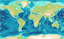
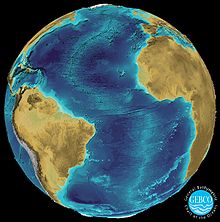
GEBCO ( English Ge neral B athymetric C hard of the O Ceans ) is a publicly available bathymetric data . It records the depths of the oceans worldwide.
organization
The GEBCO is an international organization with the aim of creating a sea map with water depths and geographical names. Most of the world's countries are involved, represented by leading oceanographers . The organization is led by the Intergovernmental Oceanographic Commission (IOC) of UNESCO and the International Hydrographic Organization (IHO).
record
The data set is based on data collected from ship echo sounders . Thus it is very accurate for frequently traveled sea routes . The topography was supplemented using satellite measurements. The GEBCO 2019 data set has a resolution of 15 arc seconds and is available under public domain with attribution.
The data set is available as a digital grid and can therefore be edited directly with Generic Mapping Tools .
Cooperation with OpenSeaMap
In a cooperation between GEBCO and OpenSeaMap , the GEBCO_08 data set is shown: water depths between 100 and 10,000 meters are shown on a 23-step blue scale with shading of the slopes. In high zoom levels, contour lines are also shown.


