Gallatin Range
| Gallatin Range | |
|---|---|
|
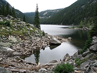
Lava Lake in the Gallatin Range, Montana |
|
| Highest peak | Electric Peak ( 3343 m ) |
| location | Montana , Wyoming (USA) |
| part of | Rocky mountains |
| Coordinates | 45 ° 18 ′ N , 110 ° 52 ′ W |
| surface | 4,753 km² |
The Gallatin Range (dt. Gallatin mountain range ) is a mountain range of the Rocky Mountains , about two thirds in the State of Montana and one third in the state of Wyoming area. The mountain range covers an area of 4753 km². The north-south extension measures a maximum of 134 km and the east-west extension 79 km. At 3343 meters, the Electric Peak is the highest point in the mountain range. Mount Washburn , the famous panoramic mountain in Yellowstone National Park , and Mount Everts in the north of the park also belong to the Gallatin Range . The mountain range is named after the US Treasury Secretary Albert Gallatin .
Web links
Commons : Gallatin Range - collection of images, videos and audio files
Individual evidence
- ↑ Peakbagger.com: Gallatin Range
.

